SOTA Challenge: CW/SSB on 2m & 70cm

The SOTA Management Team launched a special challenge for 2026: a distance-based scoring challenge using CW and SSB on the 2m and 70cm bands. The announcement is here on the SOTA reflector.

The basic idea is to encourage SOTA contacts using CW or SSB on these two bands. Because the scoring is based on distance, you need to enter the location of the other station. When chasing a summit, the location is already known by the SOTA database, but you need to have your location entered into the logging system. Summit-to-Summit contacts are easy to log because both locations are known. The hassle comes up when you are activating a summit and need the chaser’s location. An easy way to share location info is using the 6-character grid locator (e.g., DM78av at my house). Some chasers may know their 6-character locator but you may need to look it up. I usually ask the other operator if they are operating at home so I can look up the grid later. If they are away from home, I ask for enough information to be able to determine their grid.

W0C Activity

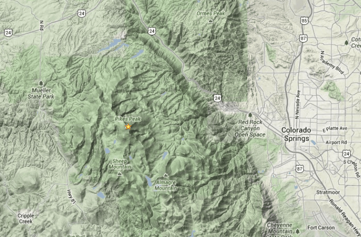
I wasn’t sure how many folks would pursue this challenge here in Colorado, but we are off to a good start. Here’s the current activator summary:

K0JJW and I have activated 5 times for the challenge, and have been pleasantly surprised with the number of chasers who get on, primarily using 2m SSB. It seems that some hams have 2m SSB capability, but don’t have many opportunities to use it. So they come out to play!

There are a few things to be aware of when operating these bands and modes:

Antenna Polarization

The first thing we ran into was the need to make sure both stations have the same antenna polarization. Common practice on VHF/UHF is to use vertical polarization for FM (and similar modes), but use horizontal polarization for CW/SSB and other weak-signal modes. The serious stations on CW/SSB will tend to have large Yagi antennas, horizontally polarized. But we soon found that many of the chasers at home were using vertical antennas on CW/SSB, because that’s what they have set up. No problem, on the summit we just flipped our handheld Yagi antenna to be vertical. The point is that antenna polarization should be taken into account, else you can experience a substantial signal loss.

Tuning in SSB

Another issue that surfaced is the need to do more precise tuning when using SSB. For FM, you can just dial in 146.52 or whatever and call it good. If there is a small frequency difference between stations, it does not matter. On SSB, a few hundred Hertz of frequency difference (which is common) causes the familiar “Donald Duck” effect, so you need to tune more carefully.

Most people know that the 2m SSB calling frequency is 144.200 MHz, so they start there. But if you hear an activator on 144.2001, you should tune to match their frequency when you call them. Don’t just sit on 144.200 and think “the other station is off frequency.”

Calling Frequency

Some sources list 144.100 or even 144.060 as the 2m CW calling frequency. These frequencies can be used, but common practice in Colorado is to just call CW or SSB on 144.200 MHz. That way, people monitoring the band for activity can find it more easily. Same thing with 432.100 MHz on the 70 cm band. Clearly, posting spots on SOTAwatch can really help with making CW & SSB contacts.

When activity picks up, the calling frequency can get busy. This is why most radios have a big knob on the front of the radio that allows you to tune up or down. Standard practice is to move up 5 or 10 kHz, as needed. If you are operating on the calling frequency for a long period of time, you should not be surprised if other people show up on the frequency.  It works best if everyone cooperates, shares the frequency, and moves to adjacent frequencies when possible. This is similar to how 146.52 MHz can get busy on FM, so people shift to other simplex frequencies, such as NAAF 146.58 MHz, to spread things out.

Quansheng UV-K5

Various people have hacked the Quansheng UV-K5, a dualband HT, to operate using CW and SSB. The modification consists of loading new firmware and, in some cases, doing a simple hardware modification. This video provides an overview of how this works. Many people are having fun modifying this HT, and it is an inexpensive way to get up and running on CW/SSB.

So come on out and give CW/SSB a try on VHF/UHF.

73 Bob K0NR


Getting Started on 2m SSB

Most Active SOTA Summits in Colorado -Nov 2025

Here’s an update on the most activated SOTA summits in Colorado. See my previous report here. Mount Herman (W0C/FR-063) still leads the pack by a wide margin, with many activations by Steve/WG0AT.

A view of Pikes Peak from Mt Herman.

Genesee Mountain has passed up Pikes Peak to take second place in the running. Genessee is in a park just outside of greater Denver and is easy to access. I notice many out-of-town SOTA enthusiasts going up there to get on the air and make some contacts. Pikes Peak is a 14er but has a road to the top, and most of those activations are probably aided by a vehicle. Chief Mountain is a popular hike not too far from Denver, coming in at fourth place. Mount Blue Sky (formerly Mount Evans) is also a 14er with a road to the top. However, it dropped off the list due to the reduced access caused by recent road construction in the area.

Thorodin Mountain ranks fifth and seems to be gaining in popularity, with Carey/KX0R as a frequent activator.

The summit formerly known as Squaw Mountain, now Mestaa’ehehe Mountain (W0C/PR-082), comes in at sixth place. There is a gated road to the top, so most activators hike that road.

Most of these summits are in the Front Range section of W0C, close to major cities, which aids their popularity. The other two are listed in the Sawatch and Park Ranges, but they are also not far from the large urban areas.

First in North America

In North America, Mount Herman is second only to Mount Davidson (W6/NC-423), which currently has 846 activations, many of them by Ellliot/K6EL. Davidson is a small 1-point summit in the middle of San Francisco, so it is easily accessible to a large population. This video by W6DFM provides a tour of that summit. Another notable summit is Vollmer Peak (W6/NC-298), an easy-to-access peak with 551 activations.

So that’s your update on SOTA activations in Colorado.

73 Bob K0NR

Most Active SOTA Summits in Colorado

Height Above Average Terrain

When I get asked why I only use VHF/UHF frequencies for my Summits On The Air (SOTA) activations, I usually reply with:

Height Above Average Terrain

More specifically, I mean that using VHF for SOTA is fun because Height Above Average Terrain (HAAT) has a dramatic effect on the propagation of my radio signal.

HAAT has a specific definition, found in the FCC regulations. HAAT basically describes the height of a transmitter relative to the surrounding terrain in all directions at distances of 3 to 16 km. This HAAT calculator tool provides the HAAT of a site based on its latitude and longitude. Note that the FCC definition of HAAT compares against the terrain relatively close to the transmitter, 16 km (10 miles). For SOTA purposes, we are more concerned with distances further away.

In a recent presentation on mountaintop VHF operating (Hamcon Colorado), I provided these two contrasting examples to drive home the importance of HAAT.

Punkin Center

Punkin Center is a small town located on the eastern plains of Colorado. The elevation is 5364 feet, and its HAAT is roughly zero feet. That is, the terrain is flat. Punkin Center is a fine place to be, but it is not a very good VHF location. The radio range using a 5-watt VHF handheld radio is about 4 miles.

Pikes Peak

Compare this to America’s Mountain, Pikes Peak, which has an elevation of 14,115 feet and a HAAT of 4,445 feet. That is, it rises more than 4,000 feet above the surrounding terrain. (The height advantage is even more pronounced when looking further east towards Kansas, where the highest elevation is ~4,000 feet.) Based on my experience operating from Pikes, the VHF handheld range is over 100 miles.

The improved HAAT of Pikes Peak provides a VHF radio range that is 25 times better than Punkin Center. Again, nothing wrong with Punkin Center, but if I want to make VHF contacts, I’ll choose Pikes Peak.

Let’s compare this to using the High Frequency (HF) bands. The normal propagation mode on HF is skywave propagation via the F layer, which supports radio propagation across North America and around the world (depending on frequency, time of day, solar conditions, blah blah blah). The radio signal refracts off the ionosphere and can go very long distances. From Pikes Peak, I can work the world. From Punkin Center, I can work the world. Not much difference, except the views from Pikes are generally better, and the oxygen is less plentiful.

So when I hike up a mountain, I am excited to get out the VHF gear and see what contacts I can make due to the improved HAAT. I don’t get as excited about working HF, because I can do that from home…or Punkin Center, or other places, with similar results.

Other SOTA activators see it differently, and that is just fine. (VHF contacts represent only ~20% of all SOTA contacts.) There are many ways to enjoy SOTA and ham radio. Just make sure you have fun messing around with radios.

73 Bob K0NR

Laurel Makes SOTA Videos

Joyce/K0JJW and I did a SOTA activation with Mike/KE0PWR on Aspen Ridge (W0C/SP-084). It turns out that Mike’s wife, Laurel, has a YouTube channel, so she shot some video of our adventure. Keep in mind that her channel is not focused on ham radio, but has a more general audience.

Some time later, Mike did a SOTA activation on his own with Laurel capturing the story via video. This was on Wander Ridge (W0C/SP-042), one of my favorite summits near the Continental Divide Trail. Yes, it was windy on top. I made a cameo appearance via 2m FM. There is a short Buena Viking plug at the end (one of my favorite local restaurants).

And finally, here is another activation with Mike on South Peak (W0C/SR-111), near Weston Pass. In this episode, Mike demonstrates how the signal disappears if you lay the Yagi antenna on the rocks. I make another guest appearance via 2m FM.

Laurel plugs the PBJ Bobo’s, which are now my favorite hiking snack. (I am not addicted to these things. I can stop eating them anytime I want.)

Great job, Mike and Laurel!

73 Bob K0NR


Ham Radio License Class – Monument CO

The Tri-Lakes Monument Radio Association is offering an amateur radio license class that includes the Technician (beginner) license material and the General license material. You can pursue Technician, General, or both!

Starts March 1st

• Earn or upgrade your FCC Amateur Radio License.
▪ Earn the FCC Technician license or upgrade to the FCC General license.
• Convenient online learning with personal assistance and demos.
• Learn to operate ham radio for emergency communications.
• Learn to use the many VHF/UHF FM radio repeaters in Colorado.
• License exam session included, all learning materials included.

Instruction:

• A 20-hour, paced course of study
• Initial session equipment demonstrations
• Student self-study with the Ham Radio School Technician or General License Course, includes eBook readings, Video instruction, Focused reviews and quizzes, Optional in-depth learning media, Practice exams
• One-on-one personalized support from a knowledgeable and experienced ham radio operator
• Regular review sessions for Q&A, extra help

Schedule:

• Introductory Session, In Person  Sat March 1, 1-4 pm Woodmoor Barn, Monument
• Zoom Instructional Review Sessions: Thursdays 7 to 8 pm
• FCC License Examination Sat March 29, 10:30 am Monument Library
• Get On the Air Session, In Person  Sat April 5, 1-4 pm Woodmoor Barn, Monument

Class registration fee:  $50 Technician or General  ($40 under age 18)
Register for Technician
Register for General

For questions, contact Bob Witte KØNR:  bob@k0nr.com
Sponsored by the Tri-Lakes Monument Radio Association

2024 Colorado 14er Event (SOTA)

Amateur Radio Fun in the Colorado Mountains
August 2 through 5, 2024

www.ham14er.org

Amateur Radio operators from around Colorado will be climbing Colorado Summits On The Air (SOTA) peaks and communicating with other radio amateurs across the state and around the world. Join in the fun during the annual event by activating a summit or contacting (chasing) the mountaintop stations.

This event is normally held the first full weekend in August. Again this year, we will add two bonus days to the Colorado 14er Event. The main two days remain Saturday and Sunday (Aug 3 & 4), while the bonus days are Friday Aug 2nd and Monday Aug 5th, for those SOTA enthusiasts that need more than two days of SOTA fun! Be aware that many mountaintop activators will hit the trail early with the goal of being off the summits by (1800 UTC) noon due to lightning safety concerns.

The 14er event includes Summits On the Air (SOTA) peaks, which provide over 1700 summits to activate. (See the W0C SOTA web page or browse the SOTA Atlas.) The Colorado 14er Event was started in 1991, about 19 years before the SOTA program was set up in Colorado. As SOTA grew in popularity, this event expanded from just the 14,000-foot mountains (14ers) to include all of the SOTA summits in the state. We still call it the Colorado 14er Event because, well, that’s where it all started and the 14ers are the iconic summits in the state.

Important: The recommended 2m FM frequencies have been changed to 146.58, 146.55, and 146.49 MHz, to align with the use of the North America Adventure Frequency for SOTA (146.58). The National Simplex Calling Frequency (146.52) may be used as appropriate. There will be plenty of action on the other ham bands, for more information see the operating frequencies page.

Resources:
Colorado 14er Event webpage  – Everything to Know About The Colorado 14er Event
Beginner Guide – For the first-time activator
Ham14er Groups.io  – Discussion Group for the event
Colorado SOTA groups.io – Colorado SOTA discussion group

Colorado 14er Event Task Force
info@ham14er.org

FRS3 For Colorado Backcountry

The Colorado Search and Rescue Association is promoting FRS (Family Radio Service) Channel 3 as “the default during backcountry search and rescue (backcountry SAR) emergencies.” FRS channel 3 is the same as GMRS (General Mobile Radio Service) channel 3. There is more GMRS info here. To keep things simple, no CTCSS (“privacy code”) is used…carrier squelch only.  See the CSAR announcement here: FRS Radio Use for Backcountry.

For backcountry exploring, it is important to emphasize self-sufficiency and to avoid reliance on electronic gizmos that may fail. Avoiding an emergency situation is way better than having a device to call for help, which may be many hours away. See this article for a discussion of The Ten Essentials for Hiking.

Still, the FRS3 concept has merit. Many backcountry hikers already carry FRS or GMRS radios, so designating a preferred channel makes sense. My read on this is that randomly calling for help on FRS3 will not be very effective due to the limited range of FRS radios. However, it does not hurt to try. More likely, FRS3 can be used for local comms once Search and Rescue crews have been deployed and are within a few miles of the party in distress.

Ham radio operators may want to carry a handheld transceiver capable of transmitting on 462.6125 MHz. For emergency use only, of course.

73 Bob K0NR

Fraser Does Pikes Peak

Pikes Peak is a great summit for a SOTA activation. You can hike up, drive up, or take the cog railway to get to the top. Pikes towers over eastern Colorado and has an excellent radio horizon in all directions. It is easy to work a bunch of stations on 2m FM. With a bit of effort, you can work Kansas, Nebraska, Wyoming, and New Mexico on VHF.

Fraser/MM0EFI was visiting from Scotland, operating here in the US as W0/M0EFI. Here’s his HF operating experience, with cameo appearances by Carey/KX0R, Christian/F4WBN, Elliot/K6EL, and Steve/WG0AT.

Now for the VHF fun on 2m FM. I happened to be on South Monarch Ridge (W0C/SP-058) that day and we completed a Summit-to-Summit contact on 146.52 MHz, at a distance of about 80 miles—easy contact using just HT’s on both ends.

Fraser, thanks for the fun videos from America’s Mountain.

73 Bob K0NR

Another Continental Divide Summit (W0C/RG-169)

A view of the W0C/RG-169 summit from the Continental Divide Trail. Look closely to see the game trail heading up to the right towards the saddle.

Lobo Overlook is an excellent summit and tourist spot near Wolf Creek Pass, one of the most scenic passes in Colorado. I’ve been up there for VHF contests and other mountaintop operations and initially thought it might be a SOTA summit. No such luck, as it is superseded by a higher summit nearby (W0C/RG-169). No problem, we’ll just activate that one instead. Lobo Overlook is accessed via an easy 3-mile gravel road just off the pass. The road leads to two small loops at the top, one of which is the actual Lobo Overlook while the other goes to an obvious radio site. The trail to RG-169 is best accessed from the radio site, so we parked there. Wolf Creek Pass and Lobo Overlook sit right on the Continental Divide and the Continental Divide Trail (CDT) passes through here just a bit to the west.

The Lobo Overlook road starts slightly east of Wolf Creek Pass.

Lobo Peak

This unnamed summit is listed as 11820 in the SOTA database. However, Lists of John (which was used to create the W0C SOTA database) shows this summit as 11831. My topo map seems to agree with 11831, so this might be an error. Of course, such a cool summit near the CDT deserves a name, so Joyce/K0JJW and I decided to call it Lobo Peak, for obvious reasons. (I looked for an existing nearby Lobo Peak and did not find one.)

Near the radio site, we started at the marked trailhead and headed west on Lobo Trail (878), actually going downhill to intersect the CDT about a half mile down the trail. At the trailhead, it was not obvious which summit we were headed to and it might not even be visible at that point. The summit did reveal itself as we headed down the CDT (see first photo above). We followed the CDT to a visible game trail that takes off steeply to the right (lat/lon 37.49765, -106.81515). There are several game trails that split off, heading up towards the saddle to the left of the summit and we stayed on the most established one. We set up our station within the activation zone just below the actual summit, avoiding the rock scrambling to get to the top.

The trail from Lobo Overlook to RG-169 mostly follows the Continental Divide Trail.

The one-way distance on the trail is 1.2 miles with an up-and-down profile. Lobo Overlook is only slightly lower in elevation from “Lobo Peak”. The trail starts at about 11,770 feet, descending to a low point of 11,500 and back up to 11,800 at the summit. So that produces a net ascent of about 300 feet, maybe more, one way. Of course, you get to repeat this on the way back.

The sign at the trailhead calls this Lobo Pass.

SOTA and POTA Activations

Once in the activation zone, we deployed the IC-705 on 2m FM, driving the 3-element Yagi antenna. We worked Travis/KB9LMJ on 146.52 MHz, who was mobile in Pagosa Springs. Further calling on 2m FM did not yield any contacts, but K0JJW and I did work each other on VHF/UHF. We had anticipated that this might be a tough place to activate on VHF, so we brought along the HF gear and set up an EndFed Halfwave antenna for 20m. Propagation was good and we soon worked 11 stations on 20m SSB.

This summit sits right on the dividing line between the Rio Grande National Forest and the San Juan National Forest, both valid for Parks On The Air (POTA). We opted to operate from the Rio Grande side (K-4405) because that was a new one for both of us.

This is the radio site as seen when you return from the summit, so no excuse for getting lost.

Continental Divide Trail

I’ve hiked sections of the Continental Divide Trail before, including some pre-SOTA backpack trips with Denny/KB9DPF. It is a great trail because it runs along the backbone of the Rocky Mountains. It is often accessible via roads to high mountain passes. (Another example is Wander Ridge, just off Cottonwood Pass.) Once you hop onto the CDT, you are hiking an established trail that is literally on top of the world.

This is an excellent, easy-to-access summit in the Wolf Creek Pass area. So if you are in the area, this might be one to activate. The road to Lobo Overlook is closed during the winter.

73 Bob K0NR

Four Days of SOTA Fun

For the Colorado 14er Event, Joyce/K0JJW and I decided to do one activation per day during the four-day event. We focused on 2m and 70 cm FM but also took along handheld radios for 1.25m and 23 cm. Our standard 2m/70cm portable station is a Yaesu FT-90, powered by a Bioenno battery, driving a small handheld Yagi (either a single band 2m or 70cm antenna).

Castle Rock (W0C/SP-112)

Castle Rock is just east of Buena Vista near Hwy 24.

On Friday, we activated Castle Rock, a short but challenging climb with plenty of nasty brush to scar your arms and legs. This is a summit that we’ve done before but not in the last few years. It is relatively close to our cabin so we decided to give it a return visit. Frankly, it is a lot of work for only 4 SOTA points, but it definitely gives you the feeling of a real climb. We had a late start this day due to a meeting that I needed to attend and I noted that we missed quite a few activators in the morning. We each made about 14 QSOs, mostly 2m FM, including 2 Summit-to-Summit (S2S) contacts.

Mount Antero (W0C/SR-003)

On Saturday, we returned to Mount Antero at 14,269 feet. I did the first SOTA activation of this summit in 2011 and this latest one is my fifth activation. Dennis/WA2USA, W9 Mountain Goat from Indiana, joined us for this effort. Dennis worked CW on the HF bands while Joyce and I worked VHF/UHF.

Ascending the ridge line to Mount Antero.

We drove the Jeep to 13,800 feet and hiked up from there. This turned out to be the most fun summit of the weekend, because 1) it was a 14er with an excellent radio horizon 2) the weather was perfect 3) we had WA2USA along for the ride and 4) we took our time on the summit and just enjoyed the experience. Overall, I made 28 QSOs, 10 of them S2S. I caught Jon/KM4PEH on South Monarch Ridge on all four bands: 2m, 1.25m, 70cm, and 23 cm. It was a pleasure to work Terry/WB0RBA as he did the first activation of Mount Sopris (W0C/SR-039).

Dennis/WA2USA, Joyce/K0JJW and Bob/K0NR on the summit of Mt Antero.

Wander Ridge (W0C/SP-042)

On Sunday, we headed to one of our favorite summits, W0C/SP-042, known as Wander Ridge. See my previous trip report for more detail. This activation starts with a hike on the Continental Divide Trail (and Colorado Trail) from Cottonwood Pass. It really is walking on top of the world.

Wander Ridge (W0C/SP-042) is accessed from Cottonwood Pass via a 2.5-mile hike along the Continental Divide Trail.

The weather was sunny and warm but the wind was a bit of a challenge. We made good use of the rock shelter at the summit, sitting in comfort while we made radio contacts. When we stood up to leave, we were almost knocked over by the high winds.

Bob/K0NR sitting down on the job to avoid the wind, working 2m FM.

I made 19 QSOs, including 4 S2S. Steve/WB5CTS showed up on 2 meters from Slumgullion Pass, but also had 1.2 GHz gear along, so we made a contact on that band (about 63 miles). I was not expecting 1.2 GHz activity but I did have the Alinco HT, so I used it with just a rubber duck antenna. Hey, it worked!

The Pulverizer (W0C/SP-092)

Finally, on Monday we activated The Pulverizer, near Wilkerson Pass, which is a new summit for us. See my trip report for more info: Activating the Pulverizer.

A view of The Pulverizer from just west of Wilkerson Pass.

The first three summits are in San Isabel National Forest and The Pulverizer is in Pike National Forest, so we also submitted our logs as Parks On The Air activations.

We had a great time doing these summits. I enjoyed hearing the other stations having a good time making VHF contacts. It warms my heart when someone makes a VHF contact that they did not think was possible. That is exactly the point…you never know where the signal will go so give it a try and prepare to be surprised!

73 Bob K0NR

2023 Colorado 14er Event (SOTA)

Amateur Radio Fun in the Colorado Mountains
August 4 through 7, 2023

www.ham14er.org

Amateur Radio operators from around Colorado will be climbing Colorado Summits On The Air (SOTA) peaks and communicating with other radio amateurs across the state and around the world. Join in on the fun during the annual event by activating a summit or contacting (chasing) the mountaintop stations.

This event is normally held the first full weekend in August. Again this year, we will add two bonus days to the Colorado 14er Event. The main two days remain Saturday and Sunday (Aug 5 & 6), while the bonus days are Friday Aug 4 and Monday Aug 7th, for those SOTA enthusiasts that need more than two days of SOTA fun! Be aware that many mountaintop activators will hit the trail early with the goal of being off the summits by (1800 UTC) noon due to lightning safety concerns.

The 14er event includes Summits On the Air (SOTA) peaks, which provide over 1700 summits to activate. (See the W0C SOTA web page or browse the SOTA Atlas.) The Colorado 14er Event was started in 1991, about 19 years before the SOTA program was set up in Colorado. As SOTA grew in popularity, this event expanded from just the 14,000-foot mountains (14ers) to include all of the SOTA summits in the state. We still call it the Colorado 14er Event because, well, that’s where it all started and the 14ers are the iconic summits in the state.

Important: The recommended 2m FM frequencies have been changed to 146.58, 146.55, and 146.49 MHz, to align with the use of the North America Adventure Frequency for SOTA (146.58). The National Simplex Calling Frequency (146.52) may be used as appropriate. There will be plenty of action on the other ham bands, for more information see the operating frequencies page.

Resources:
Colorado 14er Event webpage  – Everything to Know About The Colorado 14er Event
Beginner Guide – For the first-time activator
Ham14er Groups.io  – Discussion Group for the event
Colorado SOTA groups.io – Colorado SOTA discussion group

Colorado 14er Event Task Force
info@ham14er.org

June QST: SOTA, POTA and VHF Contest

My article that describes last year’s SOTA/POTA/VHF contest activation from Pikes Peak appears in the June issue of QST magazine. This VHF/UHF activation occurred on the Saturday of the ARRL June VHF Contest and qualified for Summits On The Air (W0C/FR-004 Pikes Peak) and Parks On The Air (K-4404 Pike National Forest). The article highlights the use of the North America Adventure Frequency of 146.58 MHz.

I made 80 radio contacts that day, on the 6m, 2m, 1.25m, 70cm, and 23cm bands. Not a great score for the VHF contest but quite nice for a VHF SOTA and POTA activation. My primary piece of equipment was the ICOM IC-705, which enabled all modes on the main VHF/UHF frequencies.

If you are an ARRL member, look for the article on Page 58 of the print edition of June QST or the online version. Not an ARRL member? Darn, you should fix that if you want to read articles published in QST.

If you are an ARRL member, please look at the article and consider voting for it in the QST Cover Plaque Award. Thanks!

73 Bob K0NR

Most Active SOTA Summits in Colorado

Previously, I wrote that Mount Herman (W0C/FR-063) is the most radio-active summit in Colorado. Here is a fresh look at the data, with seven Colorado SOTA summits that have at least 100 activations. The W0C page on sotl.as is quite handy for viewing this information. Mount Herman still leads the pack by a wide margin, with many activations by Steve/WG0AT.

A view of Pikes Peak from Mt Herman.

Pikes Peak is still in second place but Genesee Mountain is essentially tied with it. Pikes Peak is a 14er but has a road to the top and most of those activations are probably aided by a vehicle. Genesee is a much lower, easy-to-access summit just west of Denver. Chief Mountain has edged out Mt Evans for fourth place.

The summit formerly known as Squaw Mountain has been renamed Mestaa’ehehe Mountain (W0C/PR-082). There is a gated road to the top so most activators hike that road.

Thorodin Mountain made the list as it seems to be gaining in popularity, with Carey/KX0R as a frequent activator.

Most of these summits are in the Front Range section of W0C, close to the major cities which aids their popularity. The other two are listed in the Park Range and the Sawatch Range, but they are also not far from the large urban areas.

First in North America

In North America, Mount Herman is second to Mount Davidson (W6/NC-423) which currently has 522 activations, many of them by Ellliot/K6EL. Davidson is a small summit in the middle of San Francisco, so it has easy access for a large population. This video by W6DFM provides a tour of that summit.

So that’s your update on SOTA activations in Colorado.

73 Bob K0NR

SOTA Success on Red Mountain #3

Last year, Joyce/K0JJW and I tried to activate Red Mountain Number 3 (W0C/UR-016) for SOTA in the San Juan mountains. The map showed there was a road to the top, so we were expecting easy access. However, the road is gated off about 2 miles from the summit, requiring a hike. So we hiked almost to the summit but turned back when the thunderstorms rolled in. We retreated to safety and vowed to return another day.

Red Mountain Number 3 as viewed from Red Mountain Pass.

This week, we went back and activated the summit, along with Stu/W0STU and Liz/KT0LIZ. Red Mountain No. 3 sits just southwest of its sister summits: Red Mountain No.1 and Red Mountain No. 2. (Red Mtn 1 is also a SOTA summit, so we’ll need to activate that one sometime.)

We accessed Red Mountain 3 (RM3) by taking Highway 550 to Red Mountain Pass. The road for RM3 is County Road 14 but is not well marked. The turnoff (shown on the map above) is just south of Red Mtn Pass, going to the east (37.89587, -107.71369). County Road 14 is a narrow but easy road, barely 4WD, that leads to the gate (37.89476, -107.70774). We parked there and hiked up the road.

The sign on the gate.

I don’t usually like to hike on roads but this one turned out to be just fine. It was a nice, easy grade and was flat without a lot of rocks poking up. The sign on the gate indicates that the road crosses private property but that hikers are welcome. My GPS app shows that we hiked 2 miles one-way with 1400 vertical feet. We met about a dozen people on the hike, so this seems like a popular summit. We noted other trails and roads in the area and wondered if some of them might provide a better route but everyone we saw just used the same road that we used.


Stu/W0STU examines his VHF/UHF handheld, positioning it for optimum signal level

As you can see from the photos, we had excellent weather that day. This time, no thunderstorms to chase us off the peak!

The San Juan mountains are remote, with not a lot of people within VHF range. We were all using just VHF/UHF for SOTA, so I was concerned we could get skunked on making our four SOTA contacts. There are a few smaller towns within range and we might be able to work Grand Junction from there. I knew that Lloyd/W7SAO in Delta usually monitors 146.52 MHz and we worked him right away. After that, we called our fellow campers, James/KD0MFO and Vic/KD0OGE, working them mobile near Ridgway. We kept calling for a fourth contact and sure enough, Mike/KE5YF showed up on 2m FM. Mike is from Sweetwater, TX and was driving his Off-Highway Vehicle (OHV) over Engineer Pass. So we made our four contacts to qualify for SOTA points.

Traditional summit photo: Stu/W0STU, Liz/KT0LIZ, Joyce/K0JJW, Bob/K0NR


Liz and Joyce are hiking on a typical stretch of the road.
Bob/K0NR operating 2m FM for SOTA. (Photo: W0STU)

The four of us had a great day on the summit. We took our time and enjoyed the hike and the radio operating. The easy access and excellent views from the top make this an attractive SOTA summit if you are traveling in this area.

73 Bob K0NR

Why is a 14,000 Foot Summit Not Valid for SOTA?

There are over 50 summits in Colorado with an elevation of 14,000 feet or higher. These are commonly called fourteeners (or 14ers) and get a lot of attention from outdoor enthusiasts. Some folks have climbed all of them, which quickly leads to the question of What Is A Fourteener? This question is really about what is a distinct fourteener versus when is a summit just a subpeak of another fourteener. The Colorado Mountain Club list of 14ers shows 54 peaks, while other lists include a few more summits. Doing a search on Lists Of John reveals there are 74 locations in the state that exceed 14,000 feet. What constitutes “the correct list of 14ers” is often debated in the climbing community but I won’t try to sort that out here. I’ll use the Colorado Mountain Club list of 54 summits for this posting.

Summits On The Air (SOTA)

Obviously, if these are the 54 highest summits in Colorado, they are all going to be SOTA summits, right? Not so fast, Sir Edmund. The SOTA program generally requires summits to have 150 meters (492 feet) of prominence, a measure of the elevation of a summit relative to the surrounding terrain. From peaklist.org:

Prominence is the elevation of a summit relative to the highest point to which one must descend before reascending to a higher summit. 

A simple graphical representation of prominence.

There are exceptions in the SOTA program that allow for summits of 100-meter prominence, but this does not apply to Colorado. Paul/VK5PAS has a webpage that explains prominence as applied to SOTA.

In recent history, the folks that set up the SOTA Associations have done a great job of sorting through what is a valid summit. In the US, there are excellent databases of geographic information that make this possible. Which is to say that in a particular SOTA Association, a consistent method is applied for determining “what is a summit”? This is all documented for Colorado in the W0C SOTA ARM here: https://sotastore.blob.core.windows.net/arms/ARM-W0C-3_3.pdf

Lincoln, Bross, Democrat, and Cameron

Now, back to the Colorado 14ers. There is a popular trek that allows a climber to summit four 14ers in one day, without extreme effort. The trail starts at Kite Lake, heads up to Mount Democrat (14155 ft), then over to Mount Cameron (14222 feet), and on to Mount Lincoln (14293 feet). The return trip passes over Mount Bross (14178 feet) and back down to Kite Lake. (There have been access issues in recent years concerning private property on this loop, so be sure to check that out and respect any closures).

Map showing the area around Mount Democrat, Mount Cameron, Mount Lincoln, and Mount Bross.

If we check out the official list of SOTA summits, we will find Mount Democrat (W0C/SR-059) and Mount Lincoln (W0C/FR-001) listed but not Mount Cameron and Mount Bross. Per Lists of John, Cameron and Bross have prominences of 152 and 315 feet. The col between Lincoln and Cameron, does not drop down enough to provide Cameron with sufficient prominence. Same with the col between Cameron and Bross. Mount Lincoln has the highest elevation of those three summits and wins the honor of being listed as a SOTA summit. Note that Democrat, with the lowest elevation of the four summits, does qualify for the SOTA list due to its 770 feet of prominence. (There is a big enough dip between Democrat and Cameron.)

Now back to the list of 54 Colorado Fourteeners: Mount Cameron is not on the list but it often shows up on other 14er lists. Mount Bross is shown on the list of 54 but is not a SOTA summit. There are seven other Colorado 14ers that don’t qualify for SOTA: Crestone Needle, El Diente Peak, Tabeguache Peak, Sunlight Peak, Ellingwood Point, Little Bear Peak, and North Maroon Peak.

You don’t need to become an expert on calculating prominence to do SOTA activations. Really, the key thing is to check the SOTA list and make sure your intended summit is on the list before you hit the trail.

73 Bob K0NR

Four Days of SOTA Fun

This year, the Colorado 14er Event had the normal two-day (Saturday and Sunday) schedule plus two bonus days (Friday and Monday) for four activation days. Of course, Joyce/K0JJW and I decided to activate all four days using VHF/UHF frequencies. Frankly, we have not been doing that much hiking this year, so we were careful to lay out a plan that would work for us over four days.

Kaufman Ridge (W0C/SP-081)

On Friday, we hiked up Kaufman Ridge, which is a relatively easy summit near our cabin. I had an online meeting in the morning that caused us to get a late start this day, but we did chase some activators in the morning. On the summit, we worked a number of stations on VHF/UHF using the IC-705 transceiver. It was clear that most of the activators left their summit before noon, as is the usual practice for the 14ers and high peaks.

Normally, we focus our SOTA fun on VHF/UHF but this time I brought along an end-fed halfwave antenna for 20m and made a few 20m SSB contacts, including one with Elliot/K6EL on Mount Davidson (W6/NC-423). That’s right, a rare HF SOTA activation by K0NR. Joyce and I also turned in a log for Parks On The Air (POTA), which was San Isabel National Forest (K-4407).

Bob/K0NR on the trail up Kaufman Ridge.

Pikes Peak (W0C/FR-004)

On Saturday, I wanted to focus on making some 1.2 GHz (23 cm) contacts so we chose Pikes Peak as a good platform for that. Pikes is always fun because of its easy access (yes, we drove up) and its high location towering over eastern Colorado. We had Jon/KM4PEH and his wife join us on the summit, taking turns using the VHF/UHF bands. I made 42 QSOs on the various bands but my 23 cm contact with N0OY was the most exciting. I worked him in Salina KS on 1296.1 MHz using CW for a distance of 627km (392 mi). This is my new personal best for SOTA on that band. See this post for more detail on this contact.

Saturday was a good day for Summit-to-Summit (S2S) radio contacts, as I picked up 13 of them, all on VHF/UHF in Colorado. Joyce and I both worked Dave/W0ADV on Capitol Peak (W0C/SR-060) using 1.2 GHz FM. Capitol is a challenging climb, as shown in Dave’s video here.

Pikes Peak is in the Pike National Forest (K-4404), so we submitted our logs for POTA.

Bob/K0NR sitting down on the job, getting ready for a 23 cm activation.

Mount Antero (W0C/SR-003)

On Sunday, we got up early and drove the Jeep up Mt Antero Road, parking at about 13,600 feet in elevation. This cuts a large chunk of the distance and elevation off the ascent to 14,268 feet. Besides, who wants to hike on a 4WD road anyway? It is still a decent climb over the rocky trail to get to the top.

A view of Mount Antero, on the way up.

This was my fourth SOTA activation of Antero, including its first activation back in 2011. (Actually, I’ve activated this many more times during the Colorado 14er Event, which predates SOTA in Colorado.) The activity was down a bit from Saturday and we were much further away from the large population centers, which is a factor on VHF/UHF. Still, we both made 17 QSOs, including five S2S contacts. We submitted our logs to POTA for San Isabel National Forest (K-4407).

Bob/K0NR working 2m FM from the summit of Mt Antero.
The 70cm Yagi-Uda antenna is vertically polarized for FM operation.


Wander Ridge (W0C/SP-042)

On Monday, we activated one of our favorite summits near Cottonwood Pass, SP-042. Usually, I would refer to this as an Unnamed Summit (12,792), which is the name the SOTA database shows. Dave/W0ADV pointed out this summit does have a name: Wander Ridge, so I’ve adopted it for this special peak. The USGS approved that name in 2017 but it has not yet made it into the SOTA database.

Bob/K0NR on the Continental Divide Trail and Colorado Trail, headed to Wander Ridge.

From an outdoor hiking perspective, this was the best summit of the weekend. The hike starts at Cottonwood Pass and follows the Continental Divide Trail south toward the summit. Then, a short off-trail hike takes you to the summit. The weather and views were excellent!

Bob/K0NR and Joyce/K0JJW on the summit of Wander Ridge.

The activity was a bit light but we both made 10 contacts, enough to qualify for a POTA activation (in addition to SOTA). This summit is right on the border of San Isabel NF and Gunnison NF, and we chose to activate it from the San Isabel side (K-4407). We only had one S2S contact, with Steve/K5SJC on Pikes Peak.

All in all, it was a fantastic weekend with four excellent summit activations. It was wonderful to work our old and new SOTA friends on the VHF/UHF bands. My special thanks go to Pete/N0OY for firing up his mega 23cm station to work me on Pikes Peak.

73 Bob K0NR

2022 Colorado 14er Event (Summits On The Air)

August 5 to 8, 2022
Friday to Monday
www.ham14er.org

Amateur Radio operators from around Colorado will be climbing many of Colorado’s 14,000-foot mountains and Summits On The Air (SOTA) peaks to set up amateur radio stations in an effort to communicate with other radio amateurs across the state and around the world. Join in on the fun during the annual event and see how many of the mountaintop stations you can contact. Be aware that many mountaintop activators will hit the trail early with the goal of being off the summits by noon due to lightning safety concerns.

This event is normally held the first full weekend in August. Following up on the success of the 10-day W0C SOTA event in 2021, in 2022 we will add two bonus days to the Colorado 14er Event. The main two days remain Saturday and Sunday (Aug 6 & 7), while the bonus days are Friday Aug 5 and Monday Aug 8th, for those SOTA enthusiasts that need more than two days of SOTA fun!

The 14er event includes Summits On the Air (SOTA) peaks, which includes over 1800 summits! If you aren’t up to climbing a 14er, there are many other summits to choose from (with a wide range of difficulty). See the W0C SOTA web page at w0c-sota.org.

Important: The recommended 2m FM frequencies have been changed to 146.58, 146.55, and 146.49 MHz, to align with the use of the North America Adventure Frequency for SOTA (146.58). The National Simplex Calling Frequency (146.52) may be used as appropriate. See the operating frequencies page.

See the very cool Colorado 14er Event gear available at https://www.cafepress.com/mtngoatwear

Radio operators who plan to activate a summit should post their intent on the ham14er group via the ham14er groups.io website. Also, be sure to check out the event information at http://www.ham14er.org

For a complete list of suggested HF, VHF, and UHF frequencies see this web page.

And there is more!

On the same weekend, SOTA enthusiasts in Montana, Idaho, Washington, and Oregon will activate summits for the Pacific Northwest Not-Quite-Fourteener (PNW-NQF) event. Also on the same weekend, the Southern California SOTA group will hold their SOCAL SOTAFEST. So there will be plenty of SOTA stations to work that weekend.

Warning: Climbing mountains is inherently a dangerous activity.
Do not attempt this without proper training, equipment and preparation.

Sponsored by The Colorado 14er Event Task Force

How To Do a SOTA Activation On Pikes Peak

This post was updated on June 4, 2022, after the summit house construction was completed.

Perhaps this should be called The Slacker’s Guide to Activating Pikes Peak since I am going to describe the easy way to do a Summits On The Air (SOTA) activation on America’s Mountain. If you plan to hike up, you have my complete support but this post is not meant for you.

Pikes Peak 2

Pikes Peak (W0C/FR-004) is about 10 miles straight west of downtown Colorado Springs. See the Pikes Peak website for useful tourist information. At an elevation of 14,115 feet, the mountain towers over Colorado Springs and the other front-range cities. (You may see the elevation listed as 14,110 but it was revised upward in 2002 by the USGS.) This means that it has an excellent radio horizon to large populated areas. On VHF, it is possible to work stations in Kansas, Nebraska, Wyoming and New Mexico. See VHF Distance From Pikes Peak  and Pikes Peak to Mt Sneffels. On HF, you’ll do even better.

Pikes Peak map

Getting There

Access to the summit has three options: hike up, drive up via the Pikes Peak Highway or ride the Pikes Peak Cog Railway. Most people will probably choose the highway since the cog rail only gives you 30 to 40 minutes on the summit. (Normally, you return on the same train that takes you to the top. You can try to schedule two one-way trips but that is a challenge.)

After a few years of turmoil and construction, the summit of Pikes Peak is now back to operating normally but with some changes. The new summit house/visitors center is open and it is a beautiful new facility. The Cog Railway is also operational with brand new equipment. There is a new boardwalk that allows easy strolling on the summit and improved views near the edge of the summit.

Pikes Peak Highway

The highway is at a well-marked exit off Highway 24, west of Colorado Springs. There is a “toll” to use the highway (~$15 per person, check the Pikes Peak Highway website for the latest information and a $2 discount coupon.) Starting in 2022, you must have a reservation (2-hour window) to drive to the summit (roughly Memorial Day to Labor Day). The specifics are likely to change, so be sure to check the Drive Pikes Peak page for the latest updates.

The road is paved all of the way to the top and is usually in good shape. The only caution on driving up is that some people get freaked out by sections of the road that have steep drop-offs without guard rails. It is very safe, but some folks can’t handle it. The main caution driving down is to use low gear and stay off your brakes. There are plenty of signs reminding you to do this and during the summer there is a brake check station at Glen Cove where the rangers check the temperature of your brakes.

It takes about an hour to drive to the summit, assuming you don’t dawdle. It is best to drive up during the morning and avoid the afternoon thunderstorms.

On The Summit

The W0C Association Reference Manual (the SOTA rules for Colorado) used to suggest a “qualifying hike” of 100 vertical feet but this item has been removed from the manual. If you decide to do such a hike, I suggest you proceed down Barr Trail which is the main hiking trail coming up from the east side of the peak. Do not try to walk along the road, as the rangers will stop you. The trail starts on the east side of the summit house (towards Colorado Springs) and is marked with a sign. You have to cross over the cog rail tracks to get to it. (Please try to avoid getting run over by the train as it scares the tourists and makes a mess.)

The summit of Pikes is broad, flat and rocky, so pick out a spot away from the buildings for your SOTA adventure. There are quite a few radio transmitters on the peak so expect some interference. Since this is way above treeline, your antennas will have to be self-supporting. For VHF, giving a call on 146.52 MHz FM will usually get you a few contacts and sometimes a bit of a pileup. Be aware that on top of Pikes you are hearing everyone but they can’t always hear each other. It can get confusing. Another VHF simplex frequency worth trying is 146.58 MHz (The North America Adventure Frequency).   On the HF bands, pray for good ionospheric conditions and do your normal SOTA thing.

Your body and your brain will likely be moving a little slower at 14,000 feet due to the lack of oxygen. Don’t be surprised if you have trouble deciphering and logging callsigns. Take it slow and monitor your physical condition on the peak.

Bring warm, layered clothes, even in the summer, since Pikes Peak can have arctic conditions any time of the year. Keep a close eye on the weather since thunderstorms are quite common during the summer months. Lightning is a very real danger, so abandon the peak before the storms arrive.

73, Bob K0NR

Resources

SOTAwatch web site
W0C SOTA Website
Pikes Peak Tourist Information
Pikes Peak (W0C/FR-004) SOTA Page
Pikes Peak Webcams