For the 2014 Colorado 14er Event, Joyce K0JJW and I decided to try a summit close to our cabin near Trout Creek Pass. The basic idea was to activate a non-14er SOTA peak with good VHF paths to all of the Colorado mountains. We also wanted to demonstrate the idea of activating Summits On The Air peaks during the 14er event.

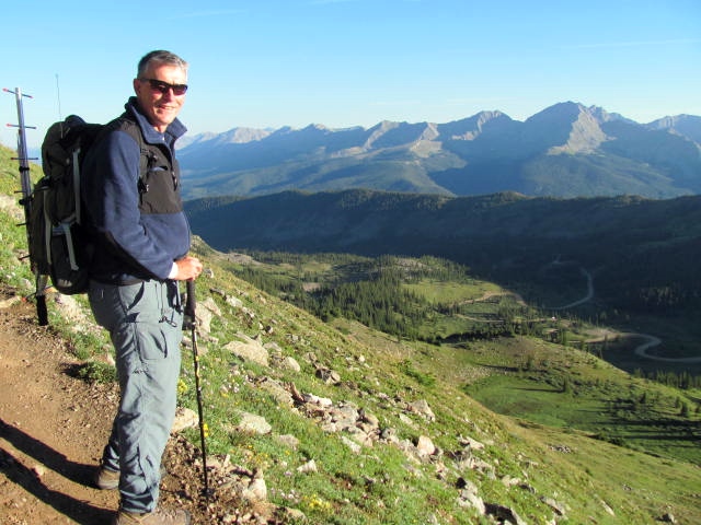
We chose an unnamed peak (W0C/SP-042) that rises to 12,792 feet near Cottonwood Pass . This summit was already on my list of SOTA peaks to activate, so that was another plus. The trail starts at Cottonwood Pass, right on the continental divide and runs along the divide for about 2 miles.

In fact, we followed the Continental Divide Trail (CDT) to get to this SOTA peak. I’ve done several backpack trips on the CDT and its always a blast to be walking along the top of the continent enjoying the awesome views.

The main trail passes over the top of another summit at 12,400 feet before continuing on to SP-042. The trail does not go to the top of SP-042, passing it on the east side. We just stayed on the trail until we were due east of the summit, then climbed up the east side which turned out to be a bit steeper than it looked. On the way down, we left the summit by following the ridge a bit to the south and found a gentler route back to the trail. My GPS app on the iPhone logged the one-way distance as 2.2 miles. It looks shorter on the map but the switchbacks add some distance.
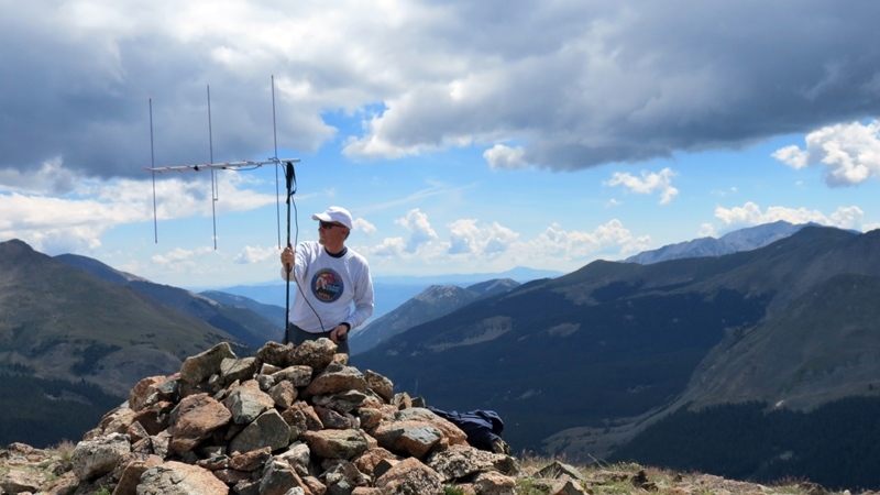
After we reached the summit around 9 am, I quickly assembled the 2m/70cm Arrow antenna and mounted it on my hiking stick. Once I had the FT-817 up and running, I spotted myself on Sotawatch.org using the SOTA Goat app. Logging was done with HamLog on my iPhone.

I worked a number of mountaintop stations on 2m fm (147.42 and adjacent simplex frequencies) with the best DX being N4MMI on Redcloud Peak, about 80 miles away. I tried calling on 2m and 70 cm SSB without any luck. Joyce made a few contacts on 446.0 MHz using an HT with a vertical antenna.
The weather cooperated all morning with mostly white fluffy clouds. We stayed on the summit until noon and then hit the trail back to the pass. This hike is now one of our favorites, really good for visitors that want a taste of hiking above treeline with great views.
73, Bob K0NR
Update 4 August 2019
Since 2014, we have activated SP-042 several times. It is really a great hike and one of our favorites. This year, we tried a slightly different route which we like better. It is a minor adjustment but worth doing. Instead of leaving the CDT early and scrambling up the northeast ridge of SP-042, we stayed on the CDT until it passes to the south of SP-042. Then we left the trail and hiked up the slope from almost due south (see map).
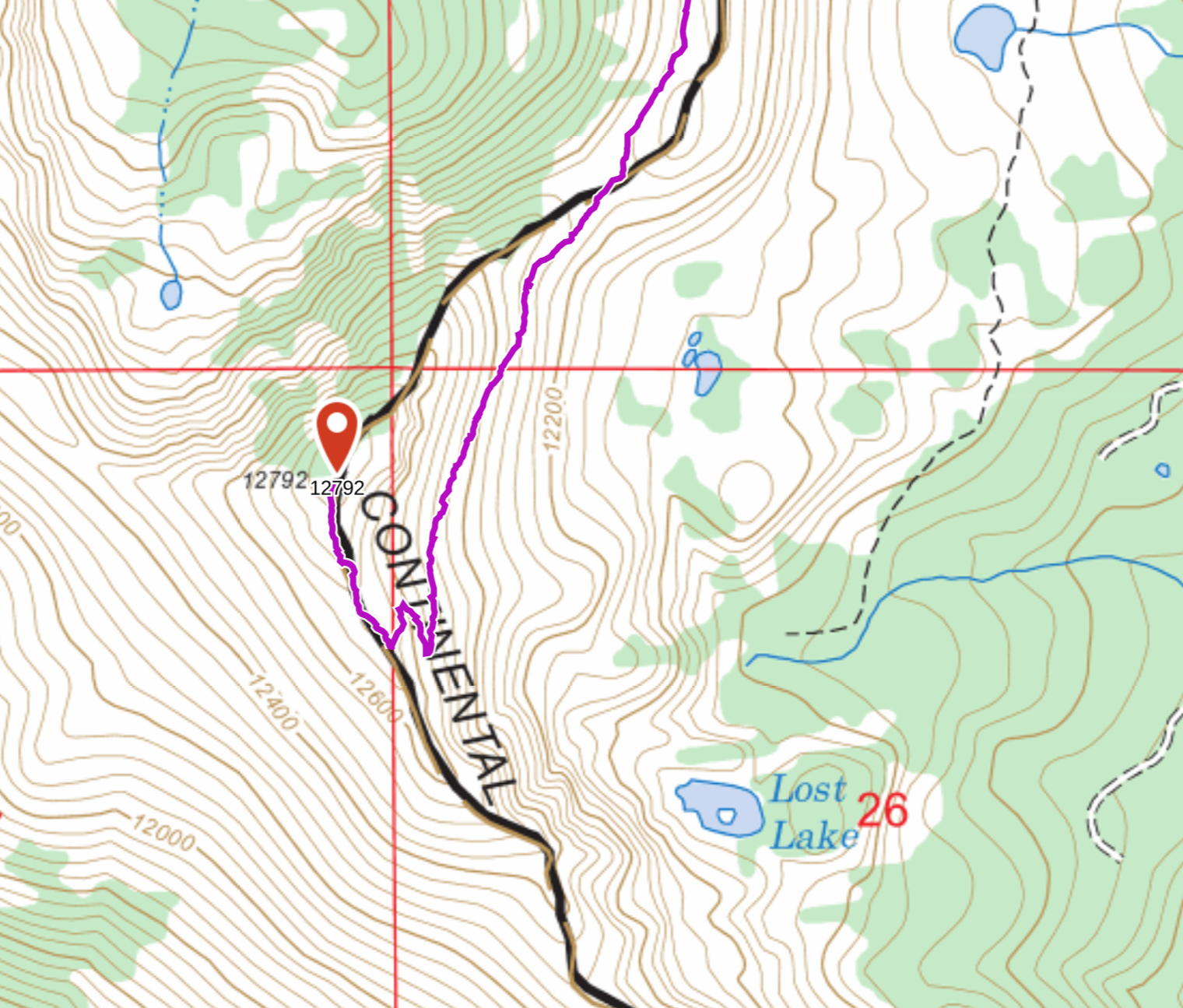
This does increase the distance of the hike to 2.6 miles (900 vertical feet), but it is easier overall.
Update 19 Oct 2023
This summit is now officially named Wander Ridge, and has been updated in the USGS and SOTA databases.