Argentine Peak (W0C/SR-019) is a high 13er (13,738 ft) in the Sawatch Range of the Rocky Mountains. I had my eye on this summit for a Summits On The Air (SOTA) activation for quite some time now. This summit is a short distance from Argentine Pass, which is the fourth-highest road in Colorado at 13,207 feet. A non-radio goal I have is to drive the Jeep up the twenty highest roads in Colorado, so Argentine Pass is on that list. Not only that, Argentine Peak sits on the Continental Divide, separating the Arapaho National Forest and the White River National Forest, so it can also be activated for Parks On The Air (POTA).

So the plan emerged: Joyce/K0JJW and I would take the Jeep to Argentine Pass and then climb up to Argentine Peak for a SOTA and POTA activation. The road is usually blocked by snow for much of the summer, making it a late summer/early fall adventure. Somehow September slipped away and it is now October, but fortunately, the road is still open. Note that the more common way to hike Argentine Pass is from Silver Dollar Lake trailhead (see KX0R trip report).
The Road
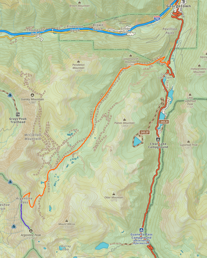
The 4WD route starts with FS 248.1 as it leaves Guanella Pass Road, about 3 miles south of Georgetown, CO (see map above). The forest service road takes off at a point where the Guanella Pass Road takes a very sharp bend. You should have a good topo map to guide you on this route as there are quite a few roads in the area. In general, you follow FS 248.1 which has some subvariants such as 248.1B and 248.1K. The exact choice of roads is not critical but, eventually, you need to get on FS 724.1 which sports a few wide and steep switchbacks up to Argentine Pass. The one-way distance is 9 miles and it took us about 1.5 hours to make the drive.
This road and route is considered moderate 4WD and FS 248.1 provides a good taste of that right after you leave the paved road. Many other sections of the road are easy 4WD but there are some challenging spots along the way. This is a real 4WD road, so you’ll need a decent high-clearance 4WD vehicle in the class of a Wrangler, Bronco, 4Runner, etc. We drove a stock Jeep Wrangler and had no trouble. However, at one spot, the wheel placement was very critical, so Joyce spotted me as I drove through it. Not that difficult…unless you screw it up.
The Climb
As shown below, the climbing route up Argentine Peak (blue line) follows the Continental Divide ridge line as it heads south from Argentine Pass. The road up Argentine Pass ends kind of high in the pass, so at first, we were walking downhill. A faint trail follows the top of the ridge but fades out in many places. Looking at the topo map, I underestimated how much up and down there would be on the ridge but it was not too difficult.
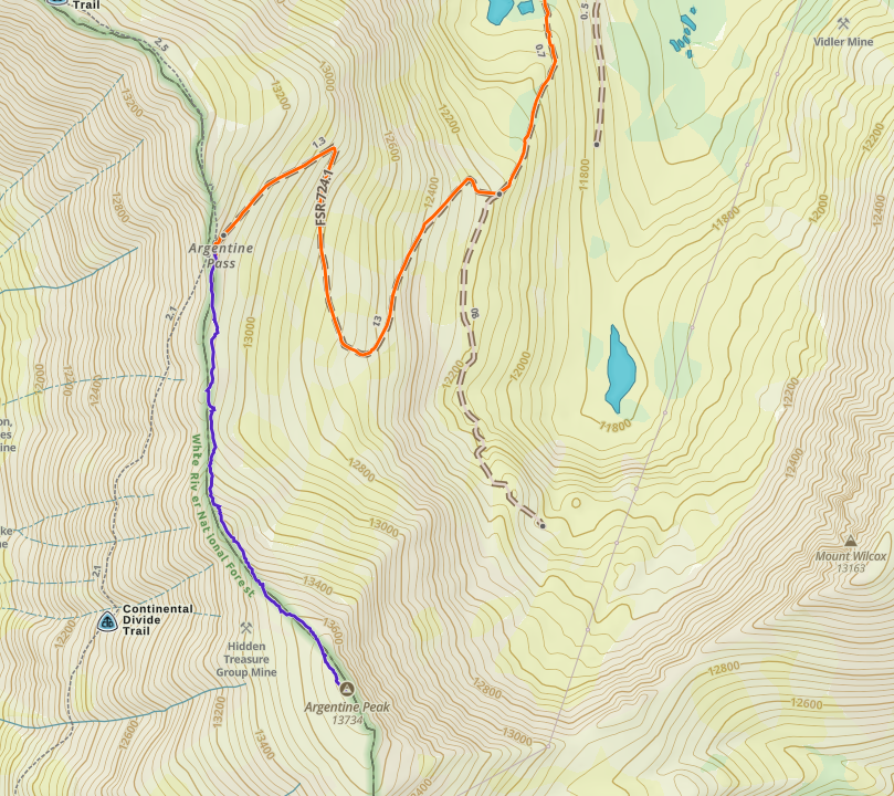
The hike is about 1 mile with 650 feet vertical (one-way). We had fantastic weather in October: sunny, with temperatures in the 40’s F and some light wind (10 to 15 mph). This is one of those top-of-the-world hiking experiences, right along the Continental Divide.
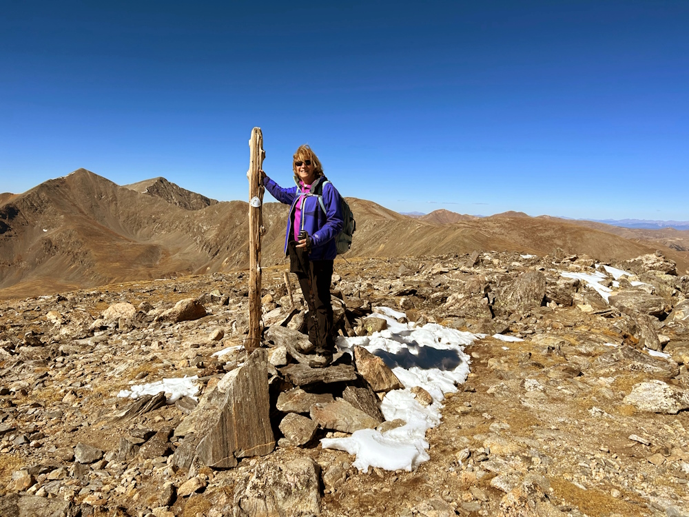
As you can see from the photos, there were some patches of snow on the ground, but it was not an issue for hiking. A real Mountain Goat (not a SOTA Mountain Goat) wandered by and paid us a visit.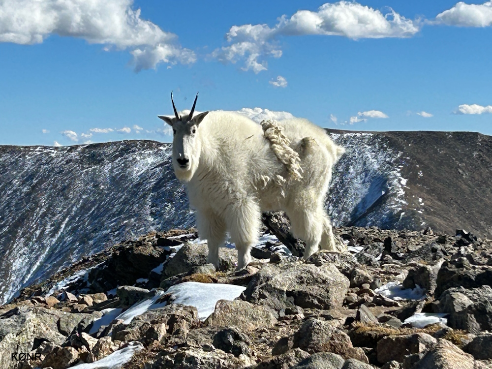
This mountain goat wandered by while we were on the summit.We used our standard 2m/70cm FM station: Yaesu FT-90 running 30 watts to a 3-element Yagi for 2 meters or a 5-element Yagi for 70 cm. We worked stations mostly on 146.52 MHz FM and a few on 446.0 MHz. With downtown Denver about 45 miles away, we easily worked stations in the greater Denver area. We were also successful working stations out to 60 or 70 miles, often with good signal reports in both directions. We both made 20 QSOs using VHF/UHF.
For POTA, we were right on the dividing line between White River NF and Arapaho NF but needed to choose one for our activation. We had previously activated Arapaho, so we chose to operate from White River NF on this trip (K-4410) which is a new park for us.
Summary
We had an absolute blast on this activation. I think it was the combination of a Jeep trip, hiking, SOTA, and POTA all wrapped into one adventure that made it so good. As a bonus, we had excellent weather and a visit by the mountain goat!
73 Bob K0NR
That mountain goat was your God sighting for the year!!
So what WH battery do you use for the FT-90? Thx
David,
I have been using the Bioenno 12 volt series batteries, mostly the 4.5 Ah version.
https://www.bioennopower.com/collections/12v-series-lifepo4-batteries
Bob K0NR