We were looking for a SOTA summit to activate near Salida, so I started to poke around using SOTLAS. There is still plenty of snow at the higher elevations, so we wanted to stay lower. SOTLAS has some useful filtering features that allow you to show only the summits of interest. Initially, I looked for a summit that Joyce/K0JJW and I had not yet activated.
Then I noticed that an unnamed summit (W0C/SC-102) had never been activated, not by anyone. When a summit has never been activated, it is often because it is really difficult to access or it is on private land. Using Gaiagps, my preferred mapping software, I checked out land ownership and the surrounding terrain.
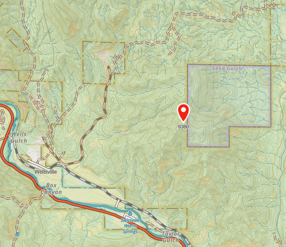
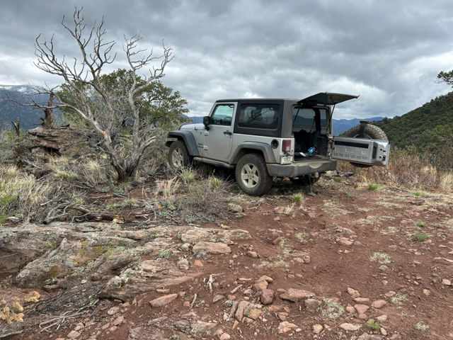
The summit is on land managed by the Bureau of Land Management (BLM). The box labeled Sand Gulch is Colorado State land. This area is clearly on public land without any private property to deal with. We considered two routes to get to the summit. One option is to hike up from the west, which would probably work. But we noticed a 4WD road that approached from the north side that might provide better access. We weren’t sure how difficult the road would be to drive but we decided to give it a try. The road turned out to be easy 4WD, with just a few steep sections that might prove troublesome if the road were muddy. It presented no problem for our stock Jeep Wrangler. There were several side roads not shown on the map that could be a diversion, so having Gaiagps on my iPhone was helpful.
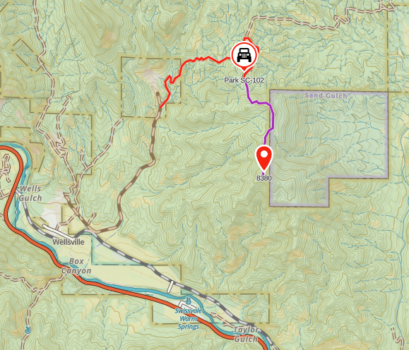
The parking spot for the Jeep is shown on the map above. We were careful with the route finding for this summit, even though it is only a mile or so. We wanted to stay on top of the ridgeline and not get lost in one of the side drainages. Gaiagps on my phone recorded the hike as 1.1 miles one way with an elevation gain of 360 feet, so not very difficult.
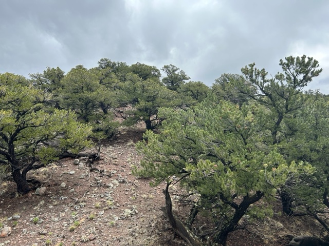
The photo below shows the typical terrain as we hiked along the ridge. There was plenty of pinion pine and juniper, along with a surprising number of small cacti. Since the summit is unnamed, we decided to call it Cactus Ridge.
We made contacts mostly on 2m FM (146.52 MHz) using the 50-watt Yaesu FT-90 transceiver driving a 3-element Yagi antenna. I was curious to see how far we could work because the summit is not that high and sits roughly in the canyon of the Arkansas River, between Salida and Canon City. As expected, Salida stations (KD0VHD, K0LPR) were close by and easy to work. Stations in Buena Vista (KF0IHL, KD0MRC, W0BV) also came in quite strong. Our best DX for the day might be N0KM near Center, CO at a distance of 55 miles. But we also worked K0EEP, N0CFM, and KA0SDE camping somewhere near Jefferson, perhaps 60 miles or so, not sure exactly. Although they were due north of us, we had to point the Yagi antenna to the south to work them, apparently getting a nice reflection off one of the high peaks. Similarly, when we worked K0LTH in Guffey (to the north), we had to point the antenna south. We tried to work Amanda/K1DDN in Canon City but were unsuccessful. I thought we might be able to funnel a signal down the canyon to her with a few favorable reflections. No luck with that, but you never know until you try.
Thanks to everyone that listened for us and worked us!
The weather report was sketchy for the day but conditions were cloudy and warm (50 deg F) when we were on the summit at 11:30 AM. Later in the day, after we were back in Salida, we had rain and snow coming down. Springtime in the Rockies.
This was a very enjoyable summit, partially because it had the experience of exploring something new. The easy 4WD road was a pleasant surprise and made us wonder where the other roads in the area lead. At 8280 feet, this summit is only worth two SOTA points. But it’s not about the points, right?
73 Bob K0NR
Thanks Bob for pointing out a summit south of Salida. I am looking forward to activating new summits while I’m in Salida this summer and will add this to my list.
We might try this one tomorrow! Camped nearby for the weekend along the Arkansas.