Rito Alto Peak is an easy 13er about 15 miles west of Westcliffe, CO in the Sangre De Cristo mountain range. This summit caught my attention because it was near Hermit Pass, one of the highest passes in Colorado at 13047 feet. We’ve been taking the Jeep up the highest roads in Colorado, and Hermit Pass was on The List. Looking around on the map, I noticed that Rito Alto Peak was an unactivated 10-point SOTA summit right next to the pass. Not only that, the summit is in the San Juan National Forest (K-4404), enabling a POTA activation as well. So how could we not do a trip up there?
Rito Alto Peak (W0C/SC-004) and Hermit Pass are about 15 miles straight west of Westcliffe, CO. To get there, take CR 160 (Hermit Road) west and then turn south onto FS 160. The turn-off is easy to spot and begins the 4WD portion of the trip. The 4WD road is not particularly difficult from a technical point of view, but the road is very rocky for most of the 9 miles. Every once in a while, the road has a smoother section, only to be followed by lots of rocks. I call these roads “moderate but annoying.” Any real 4WD vehicle should be able to handle this. We drove our stock Jeep Wrangler and it did fine. This is not a road for Suburu-class SUVs.
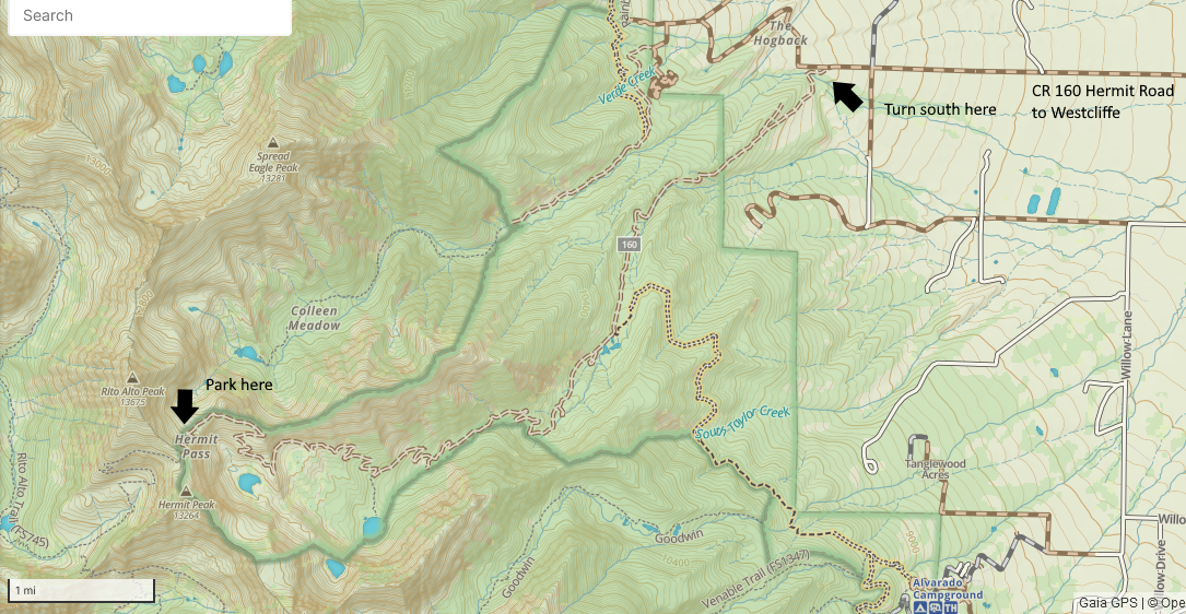
At the end of the 9 miles of bouncing up the road, we parked at Hermit Pass and started the climb there. (It took us about 2 hours to drive this road.) Of course, you can always hike some or all of the road. Useful climbing info can be found here on 14ers.com. Hermit Peak, to the south of the pass, is NOT a SOTA summit. However, further south is Eureka Mountain (W0C/SC-007), which could also be hiked from Hermit Pass.
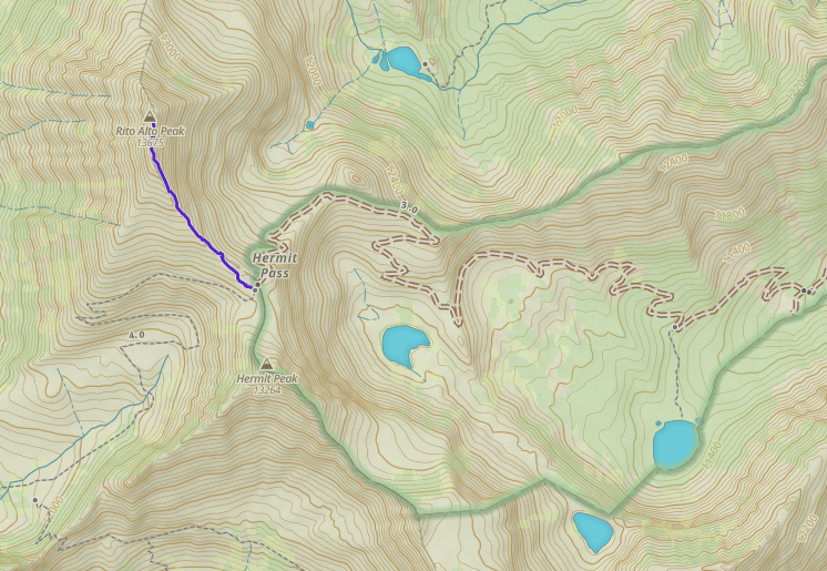
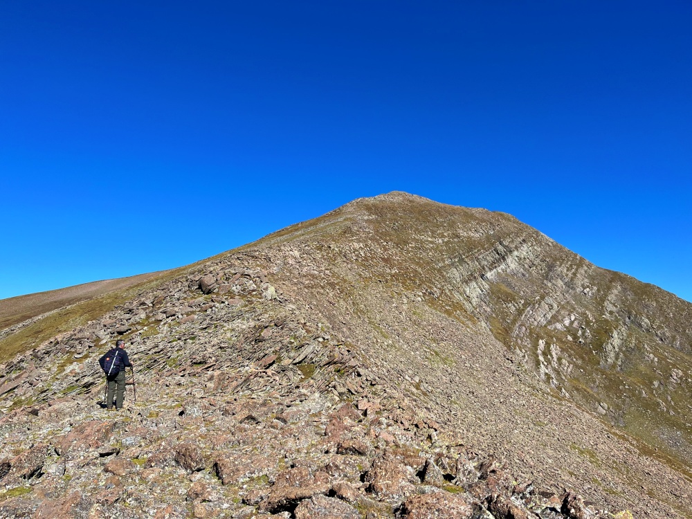
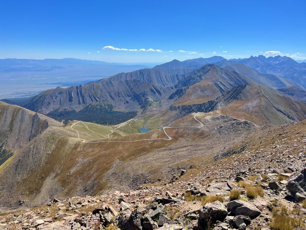
The figure above shows the track of our climbing route. There is no trail and there is plenty of talus to step over and around. The route is not critical but we tended to stay on top of the ridge line, sometimes deviating to find a better path. The distance was 0.7 miles one way with an elevation gain of 700 feet. So not too difficult, except for climbing over rocks. Trekking poles are highly recommended.
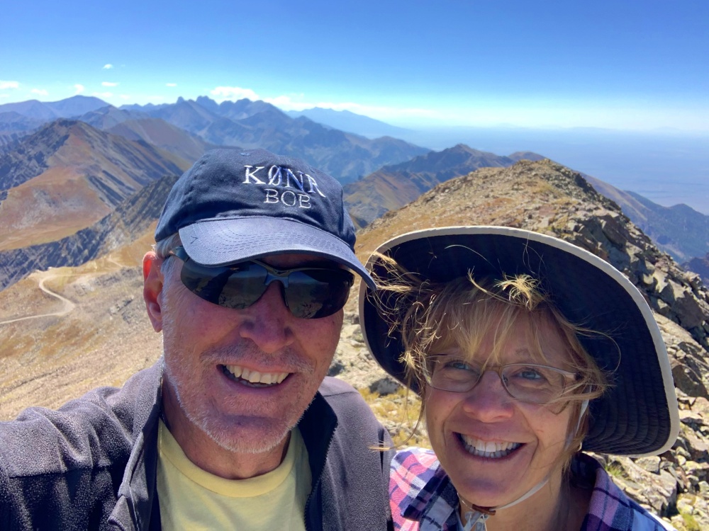
On the summit, we set up our normal 2m FM station: the Yaesu FT-90 transceiver with 3-element 2m Yagi antenna, and started calling on 146.52 MHz. Joyce made the first contact so she has the honor of doing the first SOTA activation from this summit. You Go Girl!
I was a bit worried about getting enough contacts to qualify for SOTA points but that turned out to not be a problem. We heard strong signals from the Buena Vista area (W0BV, KD0MRC) and Florrisant (K0MGL). We also made some Summit-to-Summit QSOs (S2S): WV0X (St Charles Peak, W0C/SC-031), W0ADV (Snowmass Mountain, W0C/WE-003), and W0CP (McQuaid Butte, W0C/SP-109). We also worked K0EEP, K9RZK, W9RIK, and W9NDR. Our Best DX for the day was 104 miles, with W0ADV on Snowmass. Thanks for all of the 2m FM QSOs!
As shown in the photos, the weather was excellent. We took our time on the mountain and never saw signs of thunderstorms. The climb down was easy and we returned to the Jeep. Then it was 9 more miles bouncing down the road and on to Westcliffe for a late lunch. What a great day for SOTA + POTA + Jeep trip.
73 Bob K0NR
Look at that blue sky!!! Great job to both of you – especially on 2M FM from that remote summit. Looks like you had a great day – that’s what it’s really about!