Mount Herman (W0C/FR-063) is a popular Summits On The Air (SOTA) peak near Monument, CO. It is The Most Radio-Active Mountain in Colorado and recently popped onto the worldwide 50 Most Popular Summits. The summit elevation is 9063 feet (2762m) and the grid locator is DM79mb.

Access to the summit is not difficult and most of the locals know how to find it without a problem. However, there are a few things that can trip up a first-time activator.
Most people will get to Monument via I-25, taking the main Monument exit (Exit 161). Go west on 2nd street through the old downtown area, over the railroad tracks to a stop sign at Mitchell Road. Go left (south) on Mitchell Road and then right (west) onto Mount Herman Road (FS 320). Shortly after entering the national forest, you will probably see a sign that says Mt Herman Trailhead. THIS IS NOT THE TRAILHEAD YOU WANT. Keep going on Mt Herman Road.
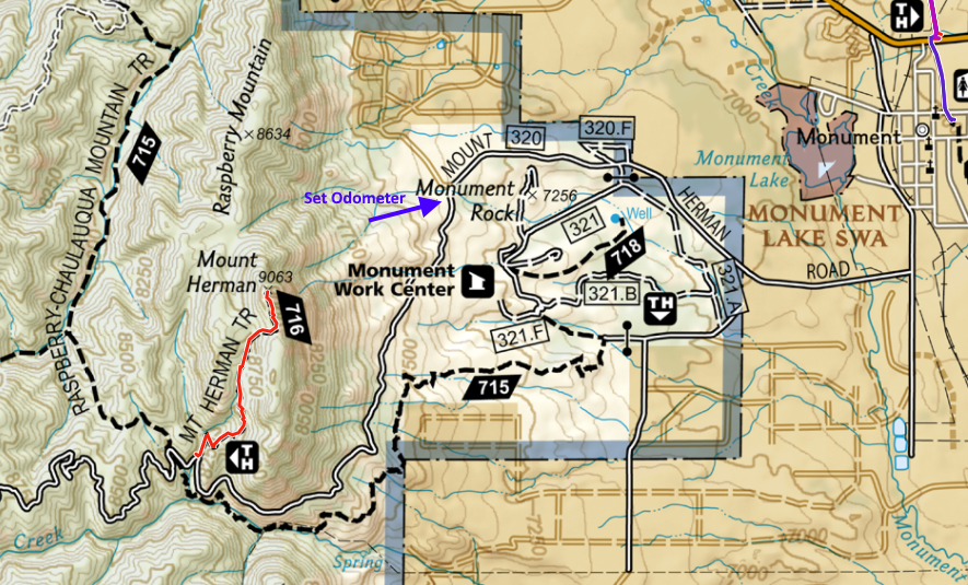 Mt Herman Road angles left (going south) at the intersection with Red Rocks Drive. At this point, reset or check your odometer as it will help you find the actual Mt Herman Trailhead (see map). Continue on Mt Herman Road for 2.6 miles, where the trailhead is off to the right as the road curves left.
The condition of Mt Herman Road varies considerably from year to year. Most of the time the road is OK for high-clearance 2WD vehicles. Sometimes it deteriates to easy 4WD. The road and trail are often usable in the winter months but it depends greatly on recent temperatures and snowfall. The road is not maintained in the winter so definitely 4WD required.
Trailhead
The actual trailhead is not that well marked, hence the need to watch the odometer. However, on most summer days, there will be cars parked at the trailhead. Parking is informal, just a gravel area off on the right side of the road.
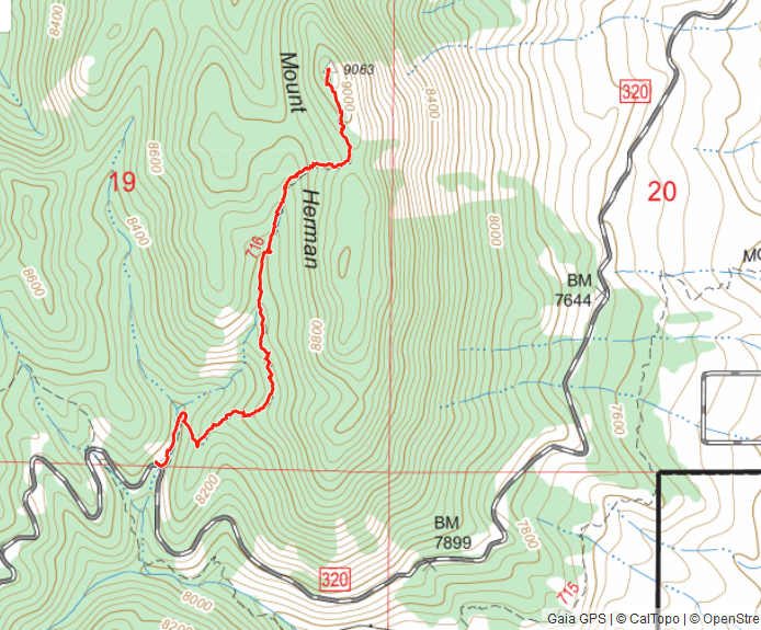
The trail to the summit is 1.2 miles one-way and 800 feet vertical. Make sure you stay to the right about 500 feet from the trailhead, on a trail that takes you up the mountain. There is another trail that continues straight at this point, which may throw you off. You should soon encounter a steep switchback at this point as you start to work your way up the mountain (see map above).
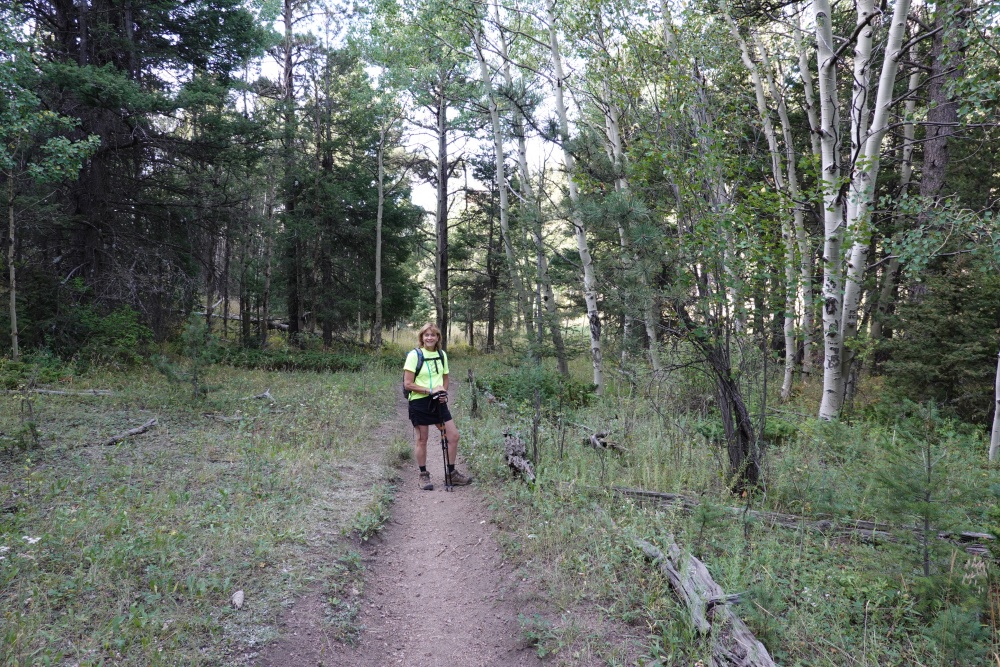
The trail is usually in decent shape with a few steep sections where the loose granite marbles can make it slippery. Hiking boots with some tread on them are recommended and trekking poles can be helpful, too.
At the summit, there is a fire ring where people sometimes camp out overnight. The hike is popular, so you’ll probably have other people stopping by. There is plenty of room in the activation area, so I set up my radio gear some distance from the actual summit.
Mt Herman is a wonderful hike with great views (even if you don’t want to do a SOTA activation). With a superb radio horizon, it is also first-rate place to make radio contacts.
73 Bob K0NR
1 thought on “Hiking Mt Herman for SOTA (W0C/FR-063)”
Comments are closed.