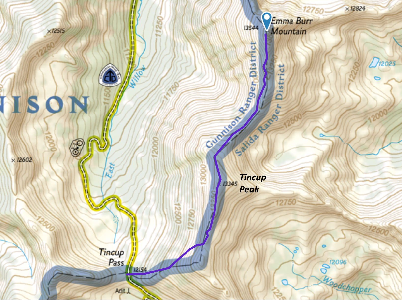
There is a SOTA (Summits On The Air) summit just north of Tincup Pass with an elevation of 13,538 feet. The SOTA database (W0C/SP-127) says the name is Mount Emma but all of my maps indicate that it is Emma Burr Mountain. (I contacted the W0C Association Manager and we’re working it out.)
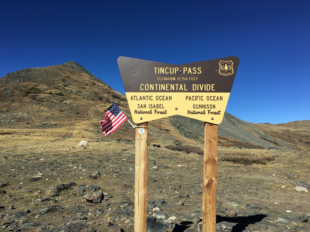
Joyce/K0JJW and I did the first activation of this summit in late September. The weather was wonderful except for the wind that pounded us anytime we were exposed on a ridgeline, which is to say it happened a lot. We started our ascent from Tincup Pass, which is at 12,154 feet on the Continental Divide (see photo). I’ve seen trip reports of people hiking this summit from the northeast (Mineral Creek area) accessible by South Cottonwood Road (FS 344), so that may be another option.
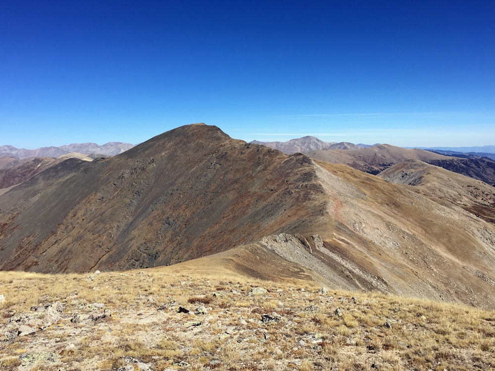
At Tincup Pass, there is an obvious trail leading off the the east. We followed this trail uphill for a while and then diverted off to the north towards the north/south ridgeline and Tincup Peak. Tincup Peak is not a SOTA summit and is not shown on all maps. It is a13,345 foot bump on the ridge heading north. Our entire hike followed the Continental Divide, always a real treat.
We followed the top of the ridge for the most part, occasionally dropping down a bit on the west side to avoid obstacles. Occasionally we followed a faint trail but for the most part this was off-trail hiking, often with significant rocks to climb over.

Once we got on top of the ridgeline, we could see our actual objective of Emma Burr (see photo below). The saddle between Tincup Peak and Emma Burr dropped down more than I expected from viewing the topo map, so we soon realized that we’d have to lose substantial elevation and then climb to get it back. Oh, well.
Once on the summit of Emma Burr, I pulled out the 2m FM station and started calling CQ on 146.52 MHz. We had no mobile phone coverage at Tincup Pass but once we got on the ridge, Verizon was working pretty well so I spotted us on Sotawatch. Our best DX was Dave/N0KM near Center, CO for a distance of 70 miles. Other stations worked: W0BV, W0RW, N1TEW, K0MGL, K0TG, KB0QEP, KL7GLK, N0EVH, KD0VHD and W0DLE. Lots of stations on 2m FM that day. I tried working W0RW on 1.2 GHz FM but we could not quite make it. I definitely heard him right at the noise floor but my 1 watt signal was not readable on his end.

My GPS app on the smartphone says that the one-way climb is 2.4 miles with 1600 vertical feet. The elevation difference between Tincup Pass (12,154) and Emma Burr (13,538) is 1384 feet, but the saddle costs you another 300 vertical feet of climbing.
Overall, it was a great day in the mountains. We knocked out two 13ers in one day and did a first SOTA activation. However, the wind pounded us quite well so we were plenty tired when we got back to our vehicle.
73 Bob K0NR
Great activation very good
Is the Yagi a BP Arrow Antenna?
BP= back packer
Yes, the antenna is the BP model with the split boom.
http://arrowantennas.com/arrowii/146-3ii.html