Walt/W0CP had recommended this Summits On The Air (SOTA) summit (W0C/SP-076) to me a while ago. Somehow it had escaped my attention, probably because it’s an unnamed peak and not that well known. Joyce/K0JJW and I decided to give it a try today and it turned out great.
We followed Walt’s directions on the SOTA website, using the southern route. We were pleasantly surprised to find a pretty good trail most of the way to the summit. There were a few spots with downed timber, where people have diverted around the logs, but generally the trail was easy to follow. The trail is not shown on many maps, including the USFS San Isabel Forest map. Thus, I was expecting considerable bushwacking to get to the summit.
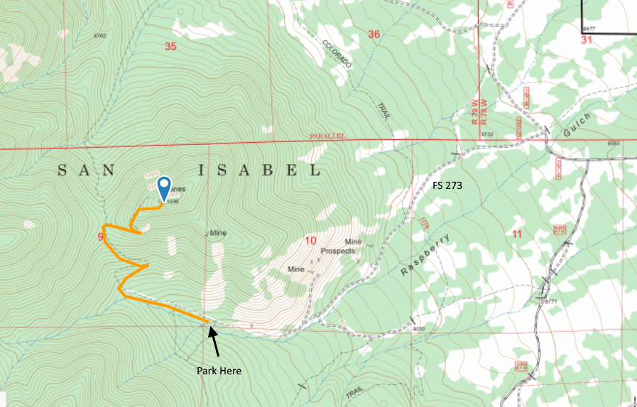
The route to the trailhead is via FS Road 273, easily accessible from Highway 285 south of Buena Vista and north of Salida. See the San Isabel National Forest map for orientation. The road is narrow in spots. Our Jeep Wrangler fit OK but a wider vehicle would get to deal with the brush on both sides of the road. The road is easy 4WD and should be passable with a high-clearance 2WD vehicle. The road had some snow on it (Nov 25, 2017) and with a few more snowstorms may not be passable.
The road continues a little further than indicated on our topo map but it is obvious when it ends. After that, the road turns into a nice trail (our route shown on the map above). The trail has a few broad switchbacks that made for easy hiking. When we got near the summit, the trail was covered by many small snow drifts, so we opted to go off trail and just head for the summit. So our last quarter mile or so is probably not optimal for summer hiking. There are several mines at or near the top of the mountain. My GPS recorded the one way distance as 1.54 miles with 1330 feet of vertical.
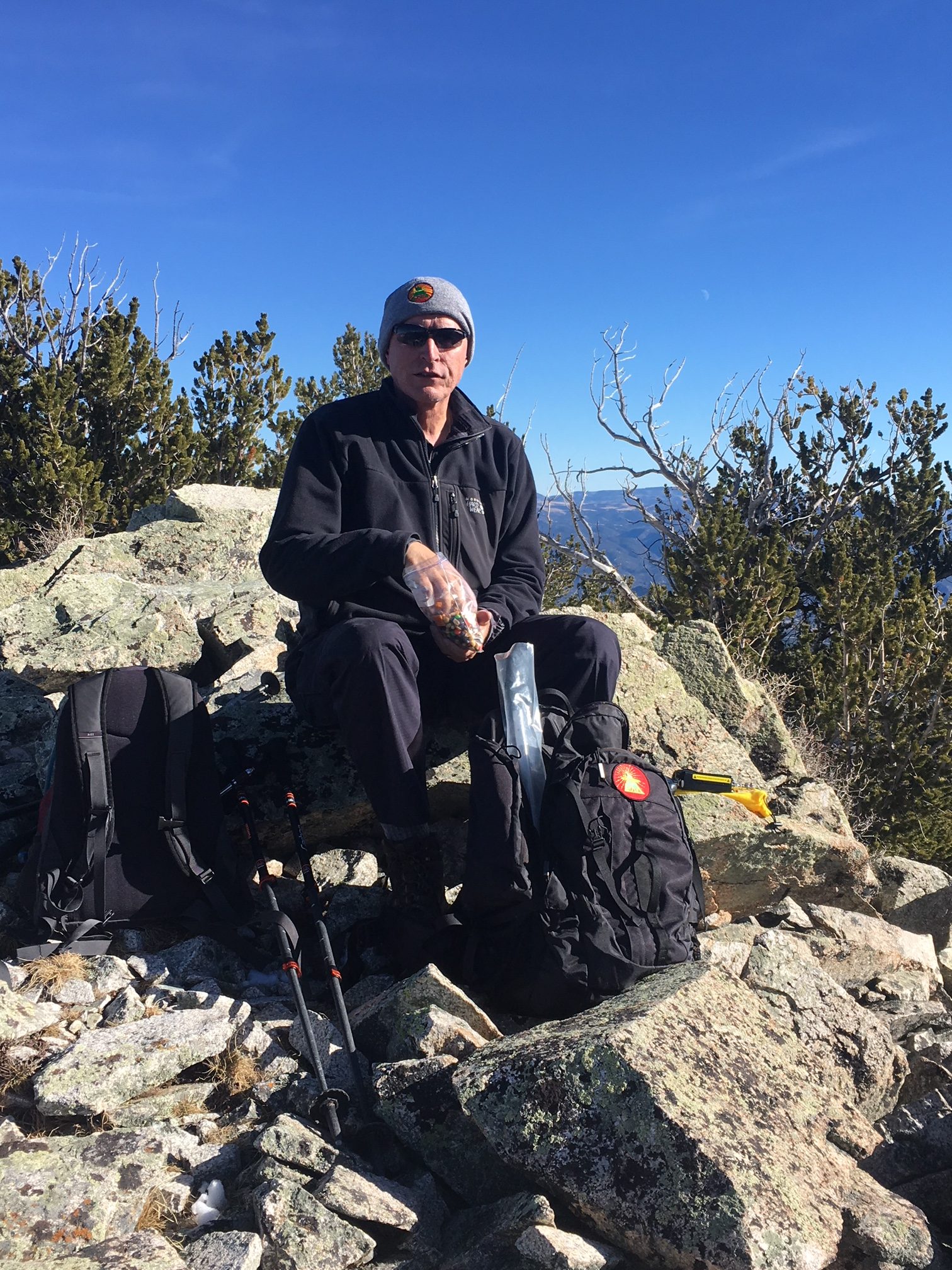
We had quite a variety of radios with us, for 2m, 1.25m, 70 cm and 23 cm, FM only. We started on the workhorse band (2m FM) with the 25W Tytera radio and a vertical half-wave antenna. It seems that someone (me) left the 3-element 2m yagi antenna at home. We quickly made contacts with KD0MRC, W0BV, KD0VHD, KE0DMT and KL7GLK on 2m and/or 70 cm. I used my Alinco 222 MHz handheld to work KD0MRC on 223.5 MHz, which is apparently the first 222 MHz SOTA contact in Colorado. (Yeah, not a popular band.)
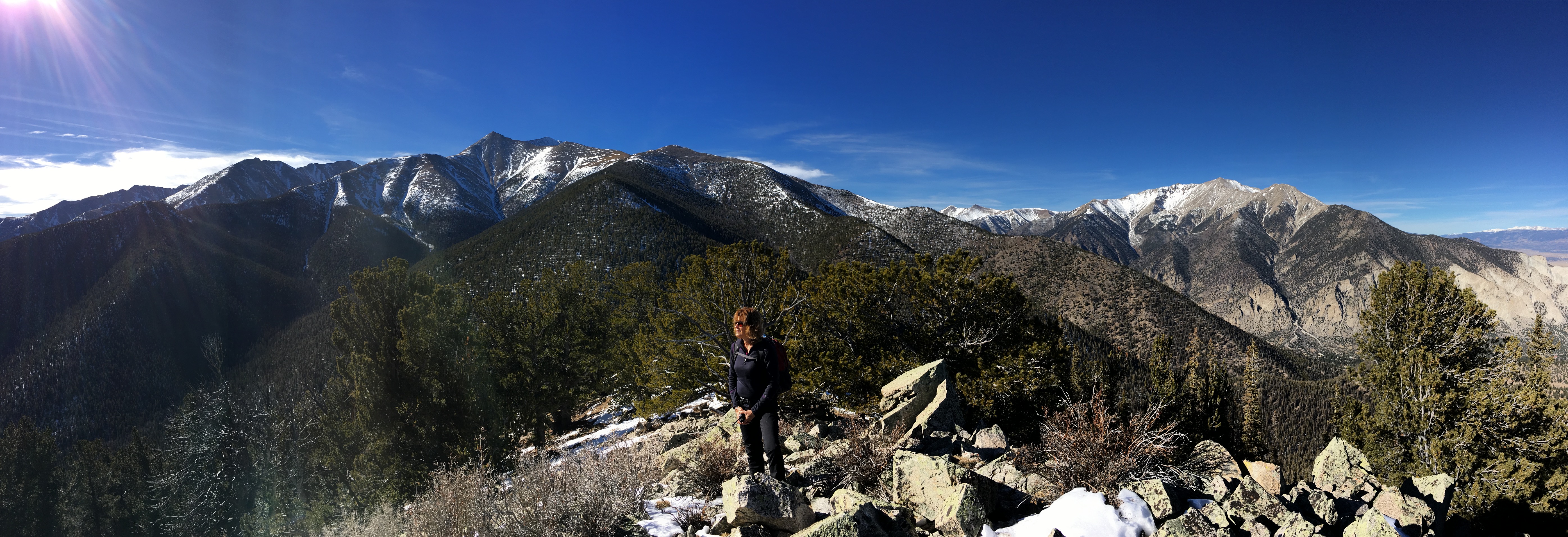
For the most part, it was pleasant on the summit, about 40 degrees F, but it got cold whenever the wind picked up. Without the wind, it was great. With the wind, kind of cold.
This is a great hike and a great summit. Only a few people have activated it for SOTA, so I wanted to write it up for others to consider. We will definitely return to this one due to it’s excellent combination of easy accessibility, good trail and wonderful views.
73, Bob K0NR
01 Jul 2018 Update
We returned for a summer activation and have a few more tips.
Access from Hwy 285: Use County Road 270, heading west. CR 270 will intersect with CR272. Keep going straight ahead onto CR 272 as CR 270 turns right and goes north. Then take CR 274 which will keep going roughly west (as 272 turns south). Then take a left onto FS 273 and follow the map shown above. The San Isabel National Forest map is very helpful.
Trail route near the summit: In the original trip report, I mentioned that we exited the trail due to snow and headed for the summit. This turns out to be a good path in the summer, too. The trail heads to an abandoned mine on the north side of the summit. Once you get to the mine, you have to go straight up to the summit, via a steep climb. It is much better to leave the trail earlier and follow the ridge line heading east to the summit (which is the path shown on the map above).