While looking for our next SOTA adventure, I noticed a never-been-activated, unnamed 13er (W0C/SP-020) to the west of Mount Princeton. I checked various maps and it looked like there was a 4WD forest service road that went up to the adjacent saddle. So Joyce/K0JJW and I decided to give it a try.
We took County Road 306 west out of Buena Vista, towards Cottonwood Pass. Then we turned left onto County Road 344 which goes to Cottonwood Lake. We continued past Cottonwood Lake until we found FS 348, also known as Hope Gulch Road. We followed this road for 5 miles to the saddle.
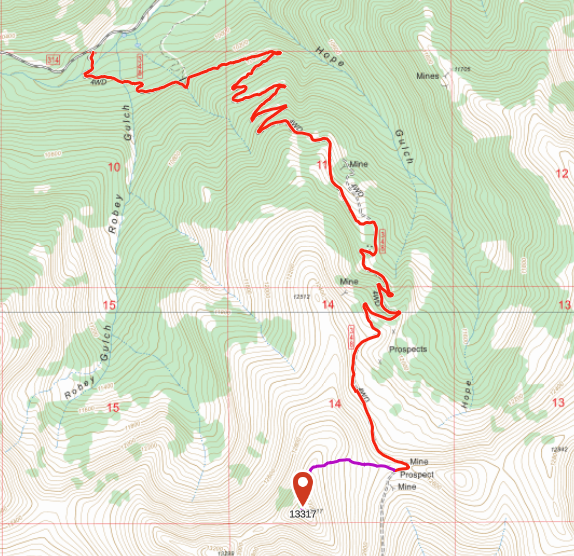
The road was easy-peasy 4WD, no problem at all with our stock Jeep Wrangler. A Suburu-class SUV can probably make it but there are a few rocky spots on the road that will require special care. There were two water crossings, one of them with about a foot of water (across Cottonwood Creek). Now this was mid-October, so the streams are not running real strong. Earlier in the year, this could be a major hazard.
Warning: water crossing at Cottonwood Creek.
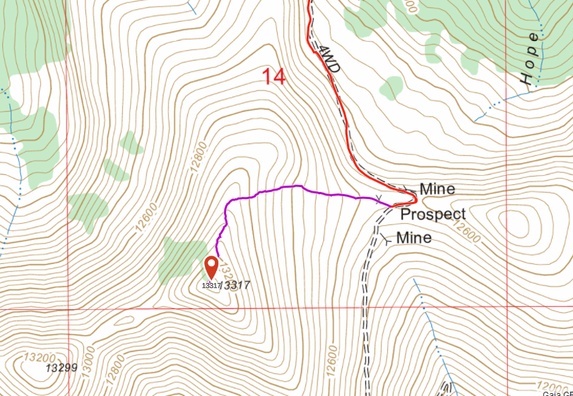
FS 348 is single lane, with long stretches without an easy passing or turnaround spot. We were happy that we only saw two other vehicles on the road.
Talus
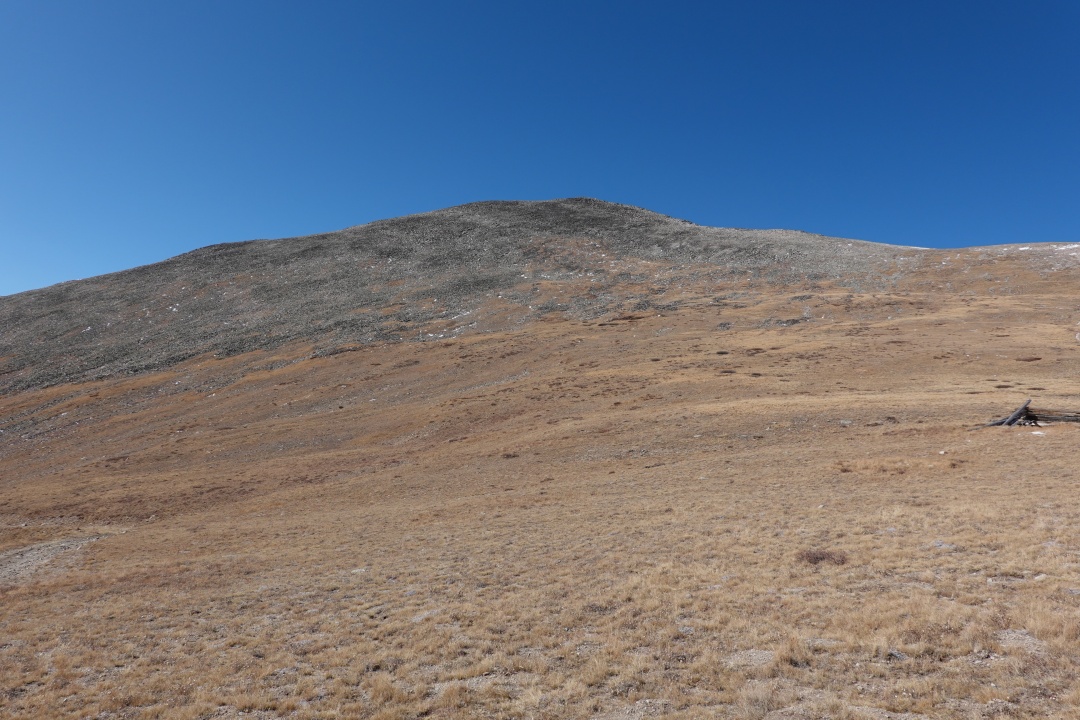
We drove a bit past the saddle (where there is a small hut/cabin) and parked where a closed side road heads off toward the summit. We hiked up this closed road and then vectored off towards the summit. The hike was only 0.6 miles and 800 vertical feet. However, there was quite a bit of talus (rock debris) to climb over which really slowed us down. The hiking route does not seem critical but following the top of the ridge seemed to be good.
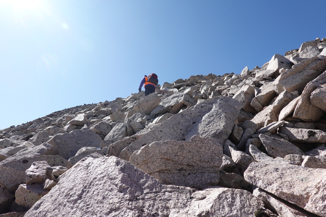
Yeah, about the talus. It isn’t any worse than other rocky summits in Colorado but it seemed to catch our attention, usually in the form of “ok, I’ve just about had it with this talus.” A contributing factor was that both Joyce and I had foot/ankle injuries in recent years. So our unofficial name for this summit became Talus.
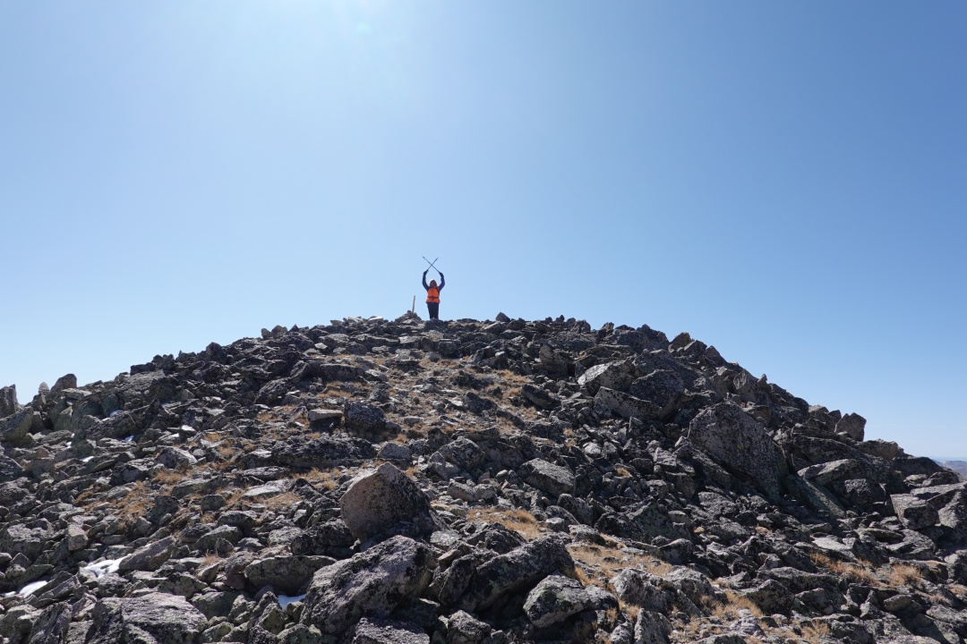
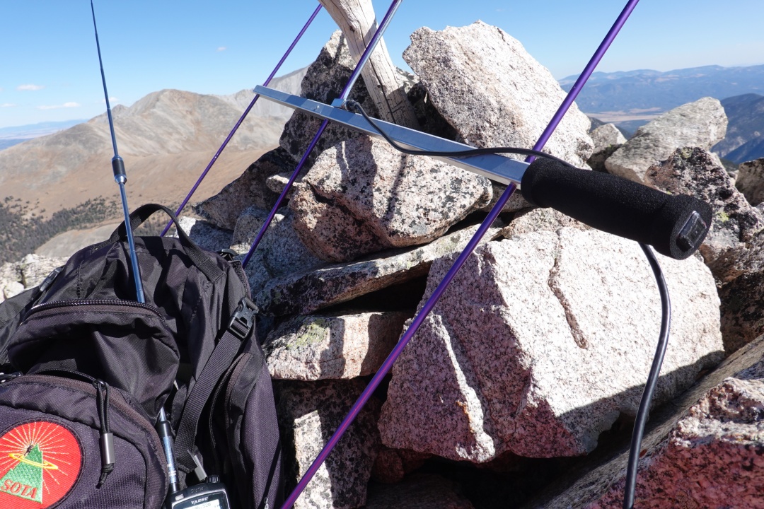
Joyce/K0JJW took the honors of completing the first SOTA activation of this summit by contacting Bob/W0BV on 2m FM. We also both logged these stations: KD0MRC, W0RW, W6JM, W0LSD and N0AJN.
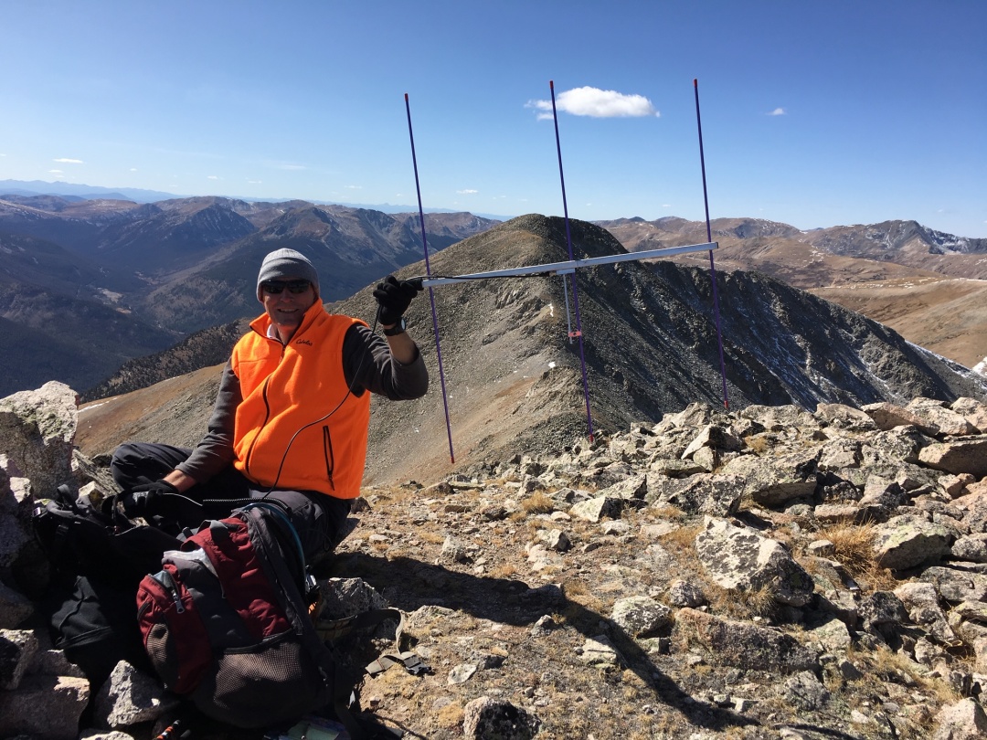
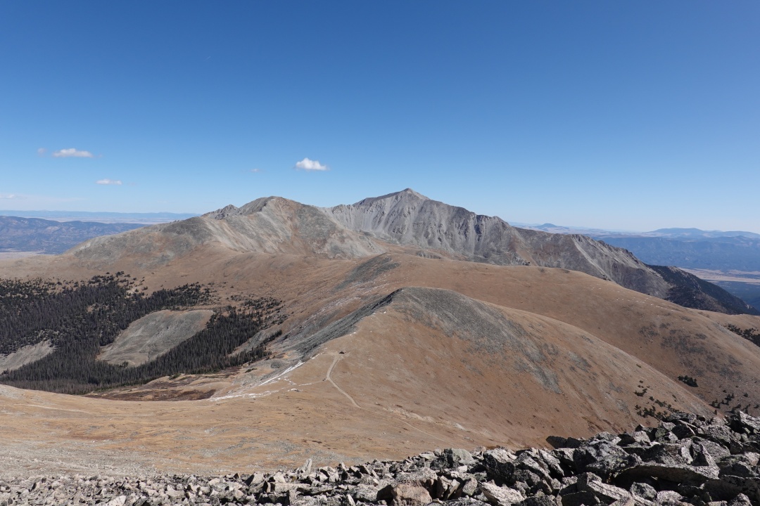
We sat there quite a while just taking in the view. Mt Princeton is due east; Mt Antero and Mt White are to the south.
You never know what your gonna get on the first activation of a summit. On this one, it turned out to be a fantastic day. The weather was sunny, temperature about 40 degrees, a little too windy at times. Late in the season, we didn’t have to worry about thunderstorms moving in and blowing us off the mountain. I liked the combination of a good 4WD road, heart-pumping but not-too-difficult hike, a first-time SOTA activation and doing it all with my favorite hiking partner (and wife).
73 Bob K0NR